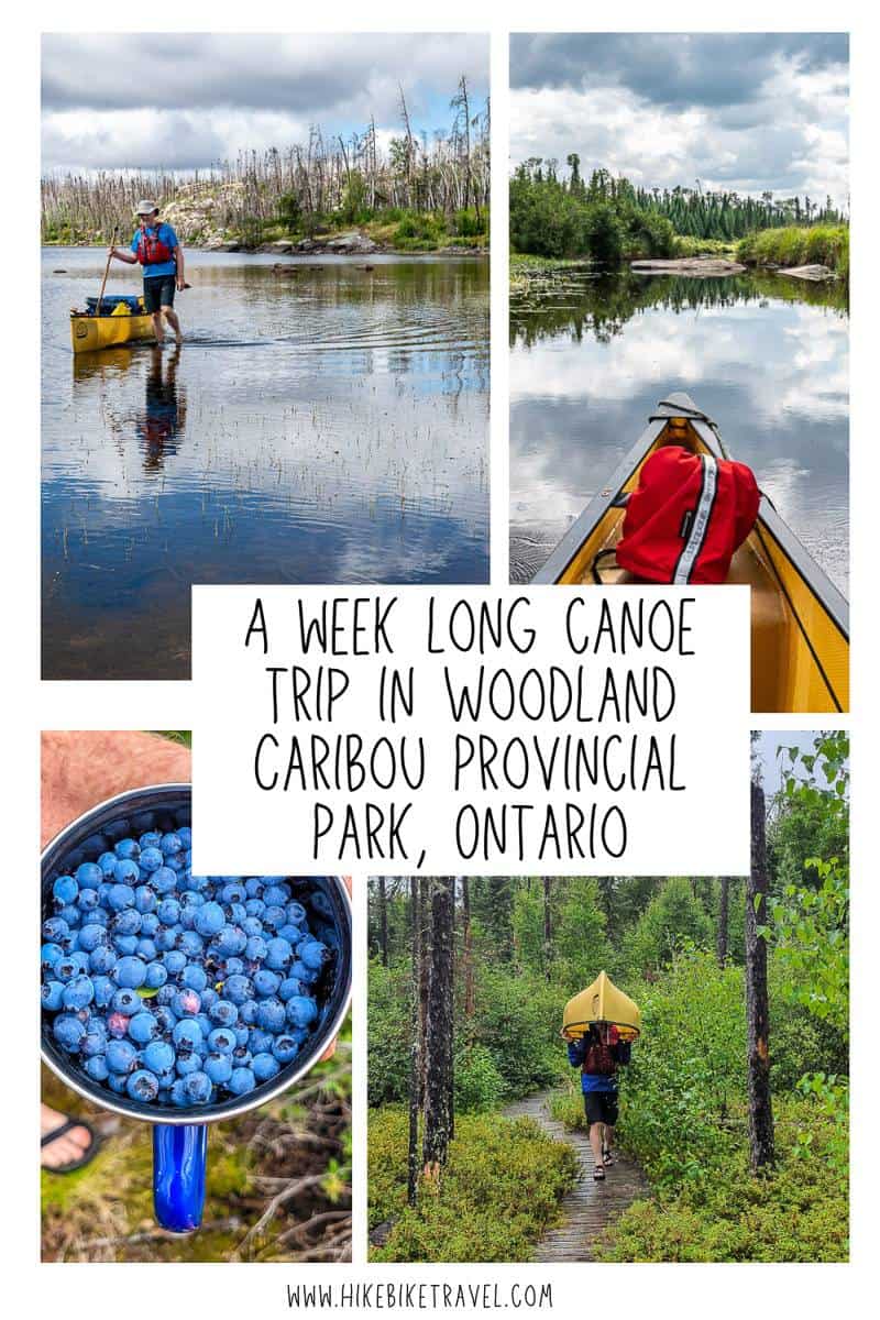
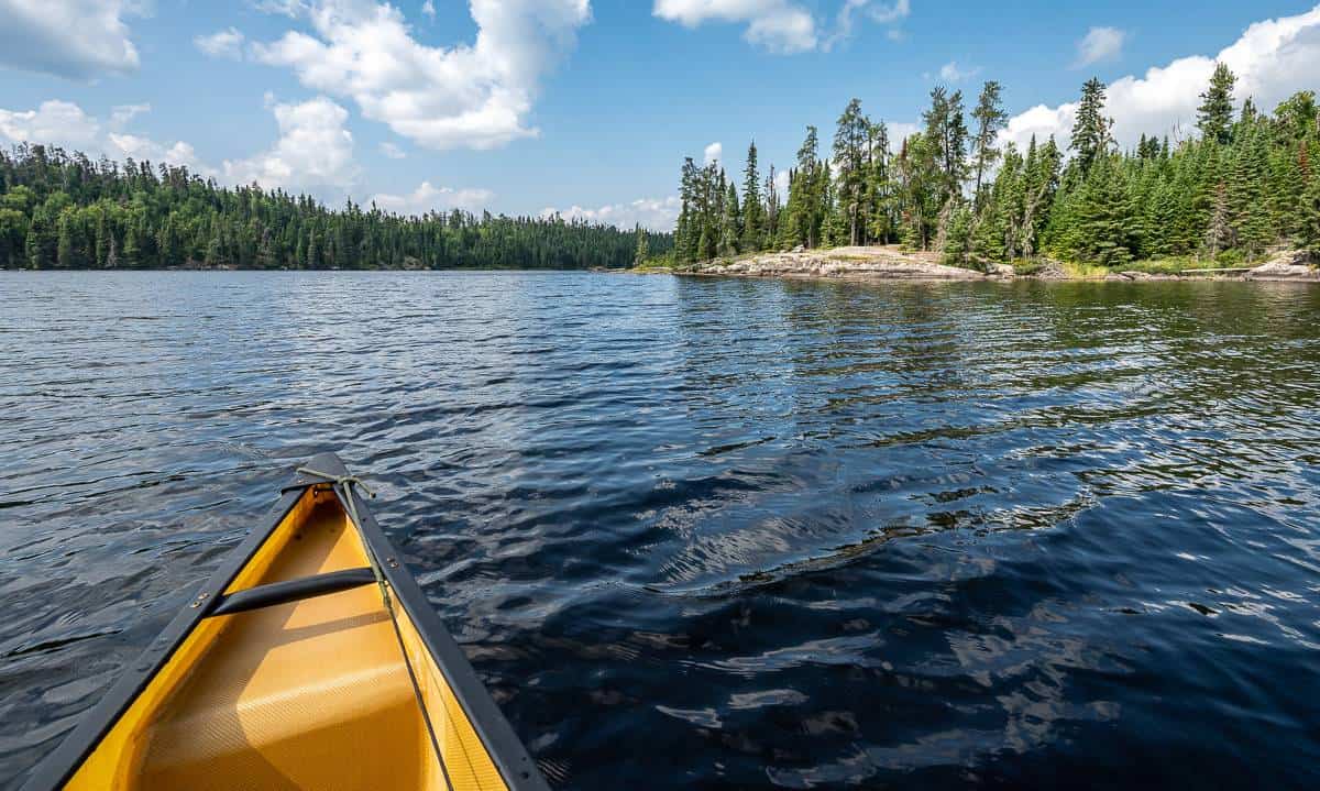
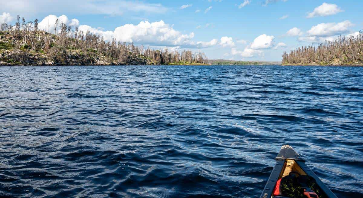
If you’re a fan of wilderness canoe trips, head to Woodland Caribou Provincial Park in northwest Ontario. The park, Ontario’s fourth largest, is one of the premium places to paddle in Canada that no one seems to know about. Annual visitation is under 750 people per year yet there are over 2,000 kilometres of canoe routes along with hundreds of unmarked backcountry campsites in over 4,000 square kilometres of unspoiled wilderness. You’re more likely to see a black bear or a moose than you are a human, even if you’re out for weeks. With no roads in the park, access is either by paddling or float plane.
Woodland Caribou Provincial Park is also part of Pimachiowin Aki (‘The Land That Gives Life’) Canada’s first mixed cultural and natural UNESCO World Heritage Site. It is significant for its diverse landscapes, intact boreal forest, pristine lakes and rivers, and the ancestral home of the Anishinaabeg who live from fishing, hunting, and gathering.
Woodland Caribou Provincial Park takes its name from the animals that call this park home. Though elusive, the largest herd of woodland caribou south of the Hudson Bay Lowlands is found here – and if you’re one of the lucky ones you’ll see one, especially in June when they’re on the move. We unfortunately did not.
Check out my Instagram reel to give you an idea of what the canoeing in Woodland Caribou looks like.
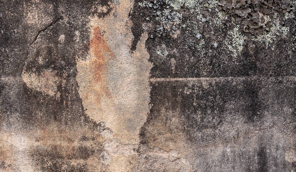
The park is aptly named, for within its 1.2 million acres (486,235 ha) roams one of the largest groups of woodland caribou south of Hudson Bay. The Bloodvein and the Gammon rivers begin here, before flowing into Atikaki Provincial Park, just over the border in Manitoba. Woodland Caribou Park is a roadless haven into which you can paddle or fly, using one of the charter services around Red Lake, Ear Falls, Kenora, and Nestor Falls. The park has several backcountry lodges and camps, but if you pick your route wisely you are more likely to see signs of ancient peoples than modern ones—the park is known for its pictographs: striking reminders of the people who traveled here thousands of years ago, silently slipping along its waterways and forest corridors, the same way canoeists do today.
Where is Woodland Caribou Provincial Park?
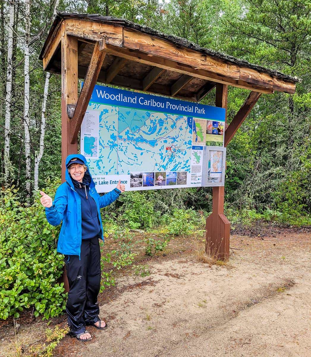
The park sits about 30 km west of the town of Red Lake, the main entry way to the park. Woodland Caribou Provincial Park covers 4,000 square kilometres than includes an extensive area west to the Manitoba border and north and south from Red Lake.
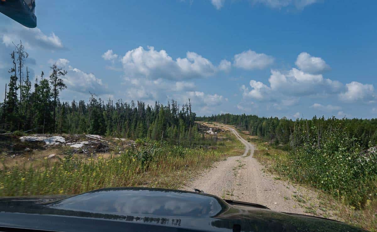
It’s a day’s drive from Thunder Bay and and about a three hour drive north of Kenora to reach Red Lake. From Red Lake you need to either fly into the park, or drive one of the rough access roads. (Shuttles are available.)
Red Lake is about a 4.5 hour drive from International Falls, Minnesota. Because of the proximity to the US, you’ll find more Americans in Woodland Caribou than Canadians.
This is a good online map of the canoe routes in Woodland Caribou Provincial Park to get you oriented.
Information about Woodland Caribou Provincial Park
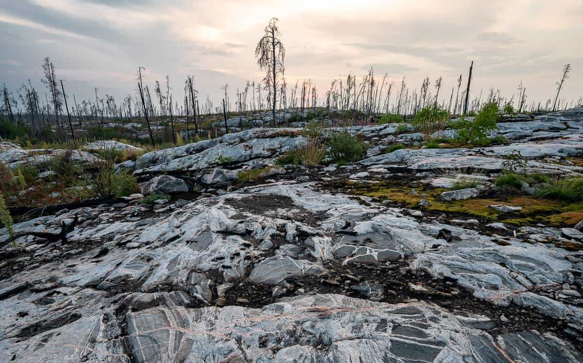
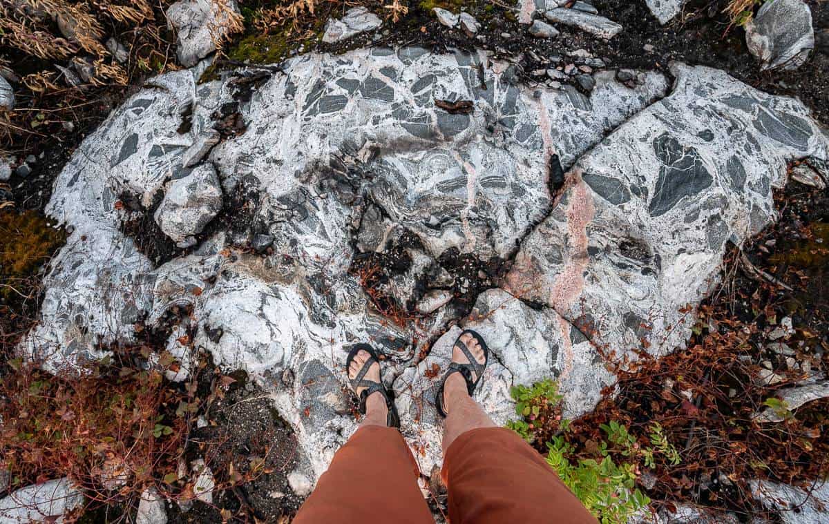
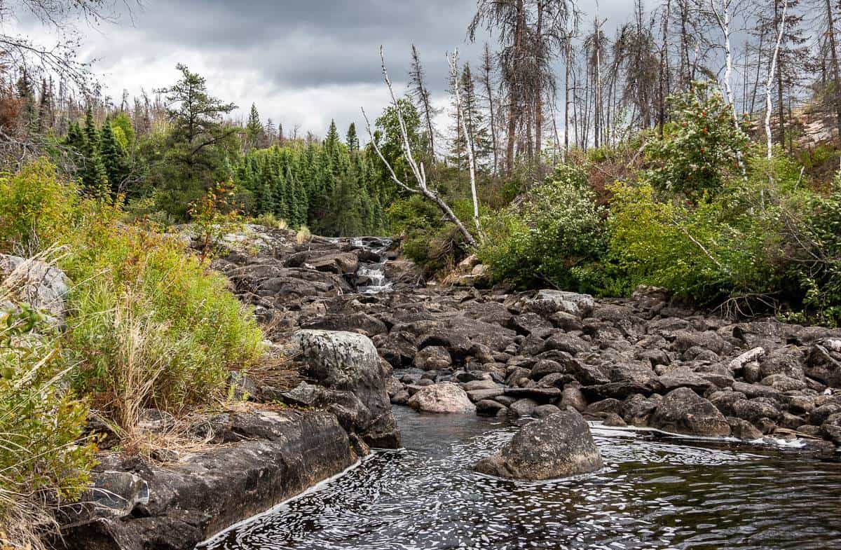
Woodland Caribou Provincial Park is an exceptional example of the Canadian Shield. The landscape is characterized by elongated lake systems, sudden changes in elevation, erratic drainage patterns, thin soils and massive bedrock outcrops. In the park, you’ll find rocks that are 2.5 billion years old. Located in the Arctic watershed, the park’s two principal rivers, the Bloodvein in the north and the Gammon in the south, flow westerly into Lake Winnipeg and eventually to Hudson Bay. This northern wilderness is so remote that canoeists and sport fishing enthusiasts can penetrate its interior and reach its backcountry campsites and outpost lodges only by water or by air.
It is the Woodland Caribou that is Pictured on the back of the Canadian quarter.
Planning a wilderness canoe trip in Woodland Caribou
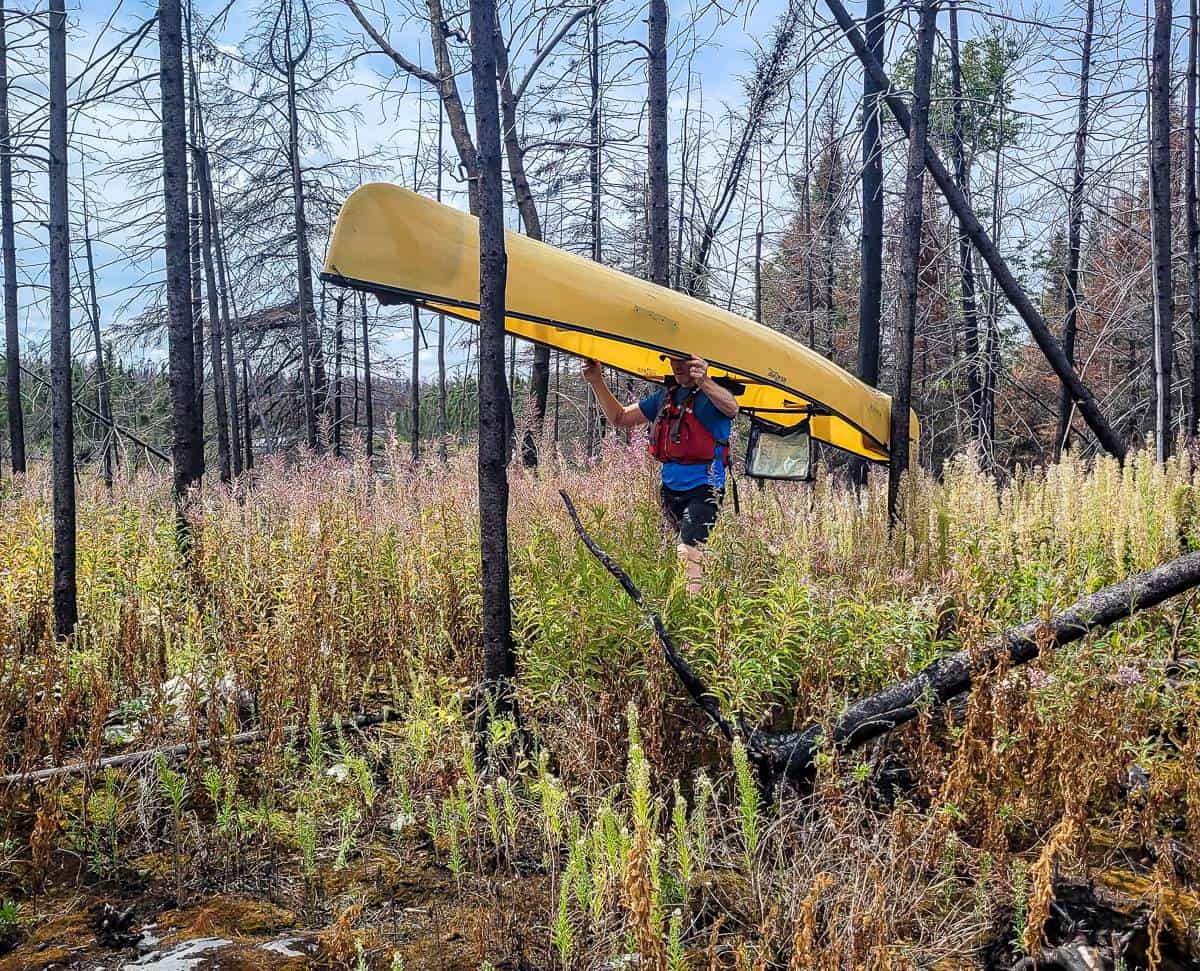
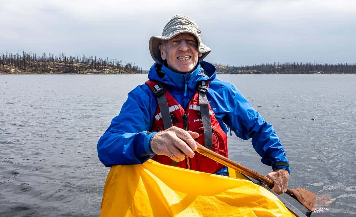
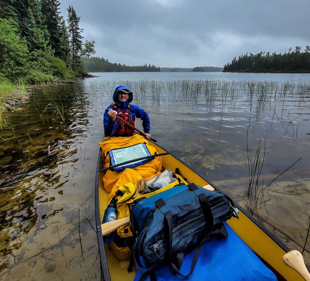
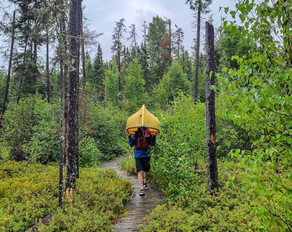
A canoe trip in Woodland Caribou is not for novice campers or paddlers. The park is remote, there are few services, and help can be a long time coming. The canoe trip in Woodland Caribou we did wasn’t difficult per se – but there was plenty of wind, several thunderstorms, and 35+ portages, some of which were tough. We found it to be a very physical trip with so much lifting and multiple portages every day. I’d recommend getting into some sort of shape before you show up for whatever you have planned. You’ll have a much better time.
If you’re not comfortable with solitude and a total lack of people, then you might find the first few days unnerving, but I bet you get used to it quickly – and come to appreciate the sense of space and quiet the park offers.
Check out this online map of backcountry campsites put out by Ontario Parks, appreciating that a major fire occurred a year after the map was made. Still, it’s a useful tool for trip planning.
We used Goldseekers Canoe Outfitting for lightweight canoes, PFD’s, paddles, shuttles – and importantly – advice from years of offering canoe outfitting in the park. Walter, one of the founders of the company, knows this part of the world incredibly well – and he is super organized. He can suggest paddling routes geared to the amount of time you have and your canoeing ability.
Another good way to start the trip planning process is to call the Red Lake parks office at 807-727-2253 and have a chat with one of the staff. Many of them intimately know the park and can be very helpful.
How long should a canoe trip in Woodland Caribou be?
You can enjoy a canoe trip in Woodland Caribou that lasts just a few days to trips that last many weeks, and occasionally even months. With a vast network of lakes, rivers, and portages you’ll have to decide what the right amount of time is for you. One of the famous paddles in the park is the historic Bloodvein River – the largest river running through the park that ultimately travels across the Manitoba border to end on the east side of Lake Winnipeg. There are several outfitters that run guided tours for this one.
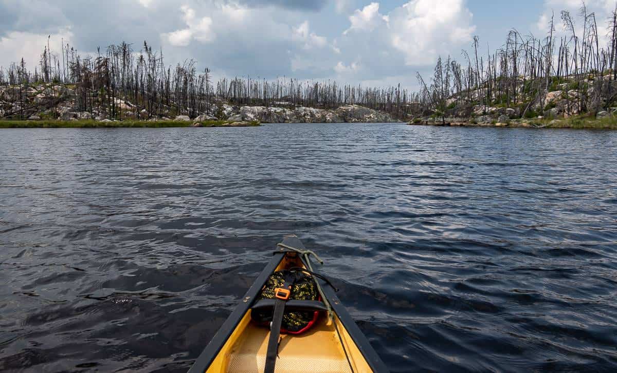
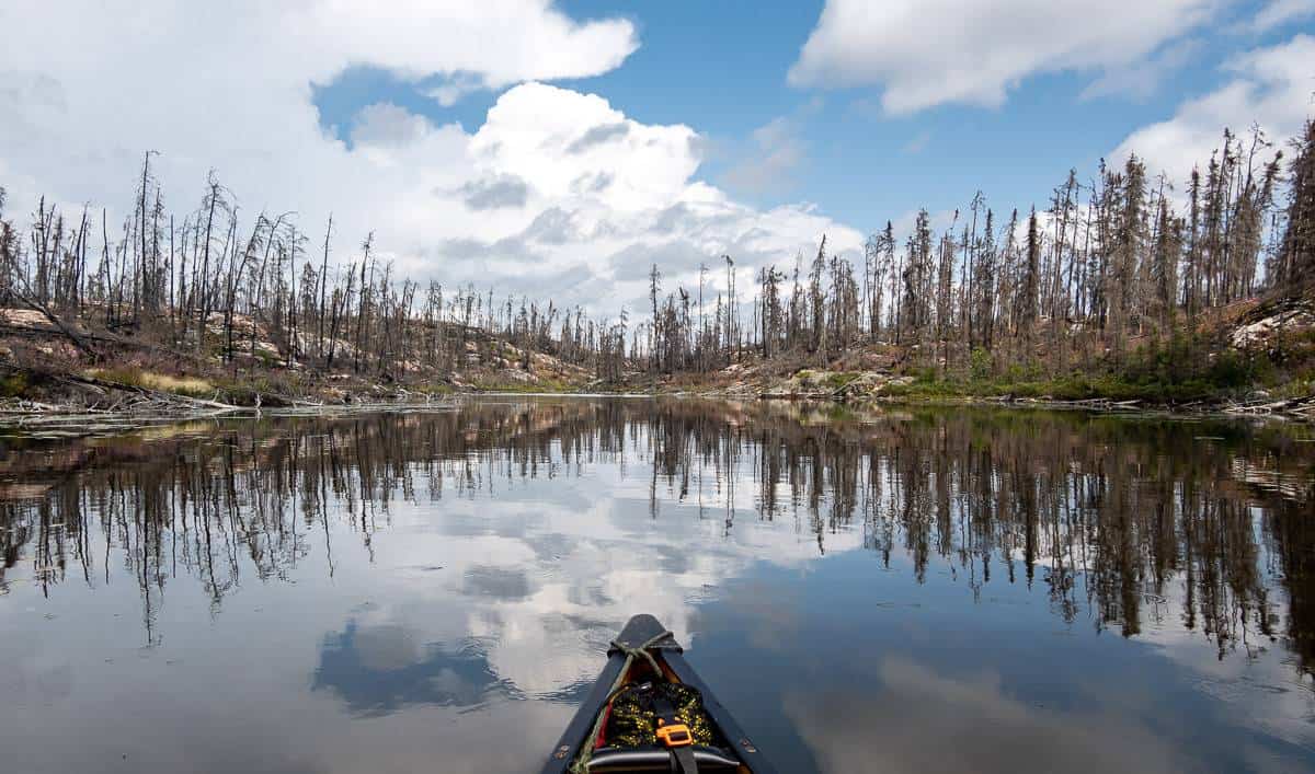
The 2021 Woodland Caribou Provincial Park fire
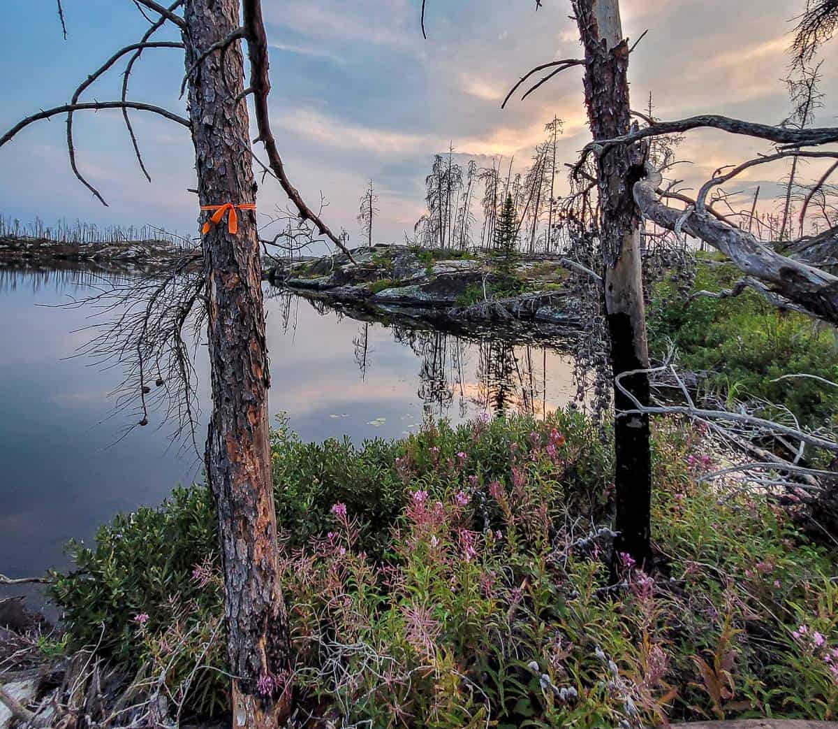
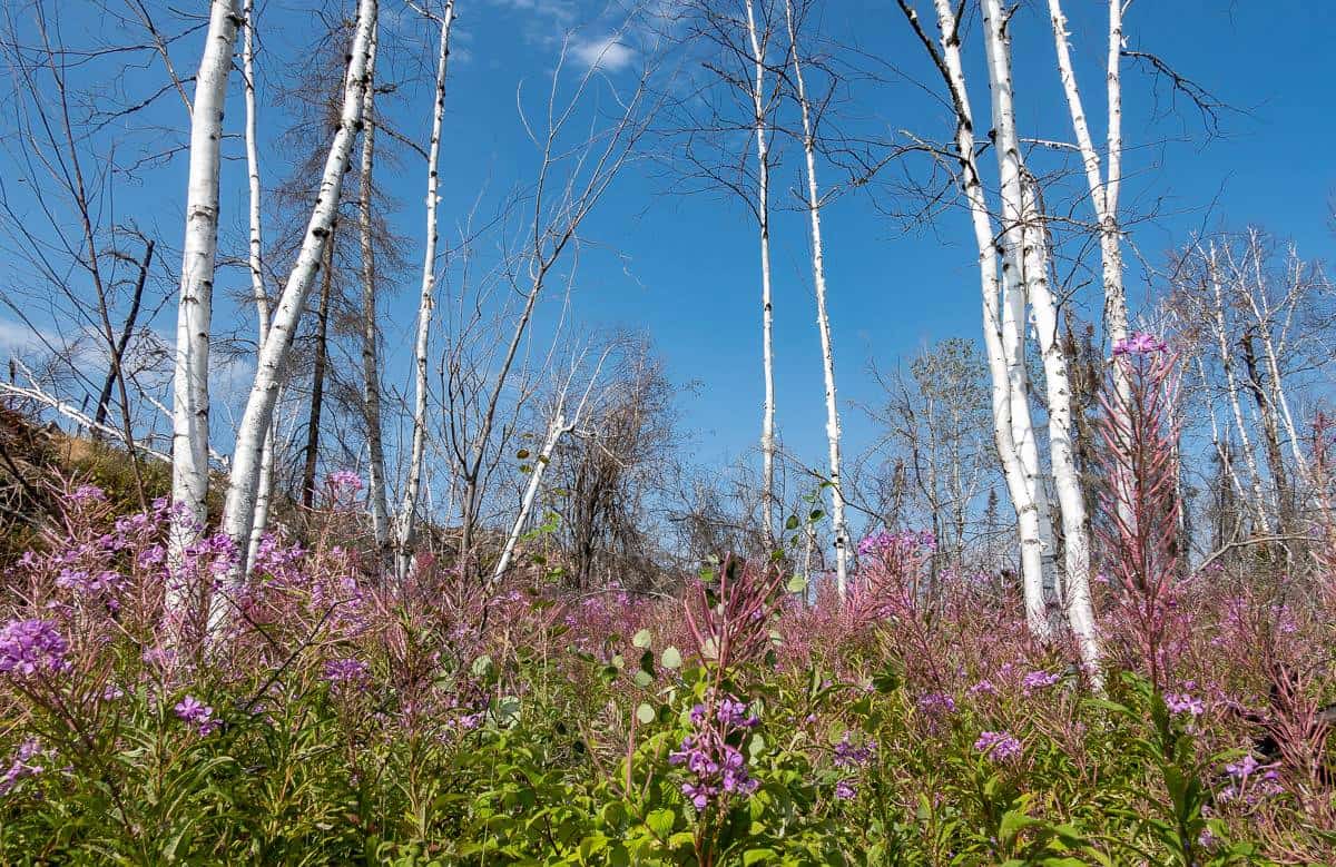
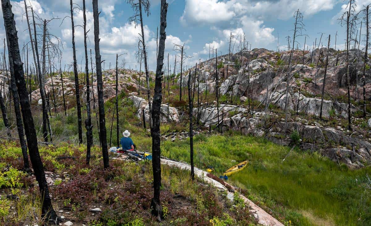
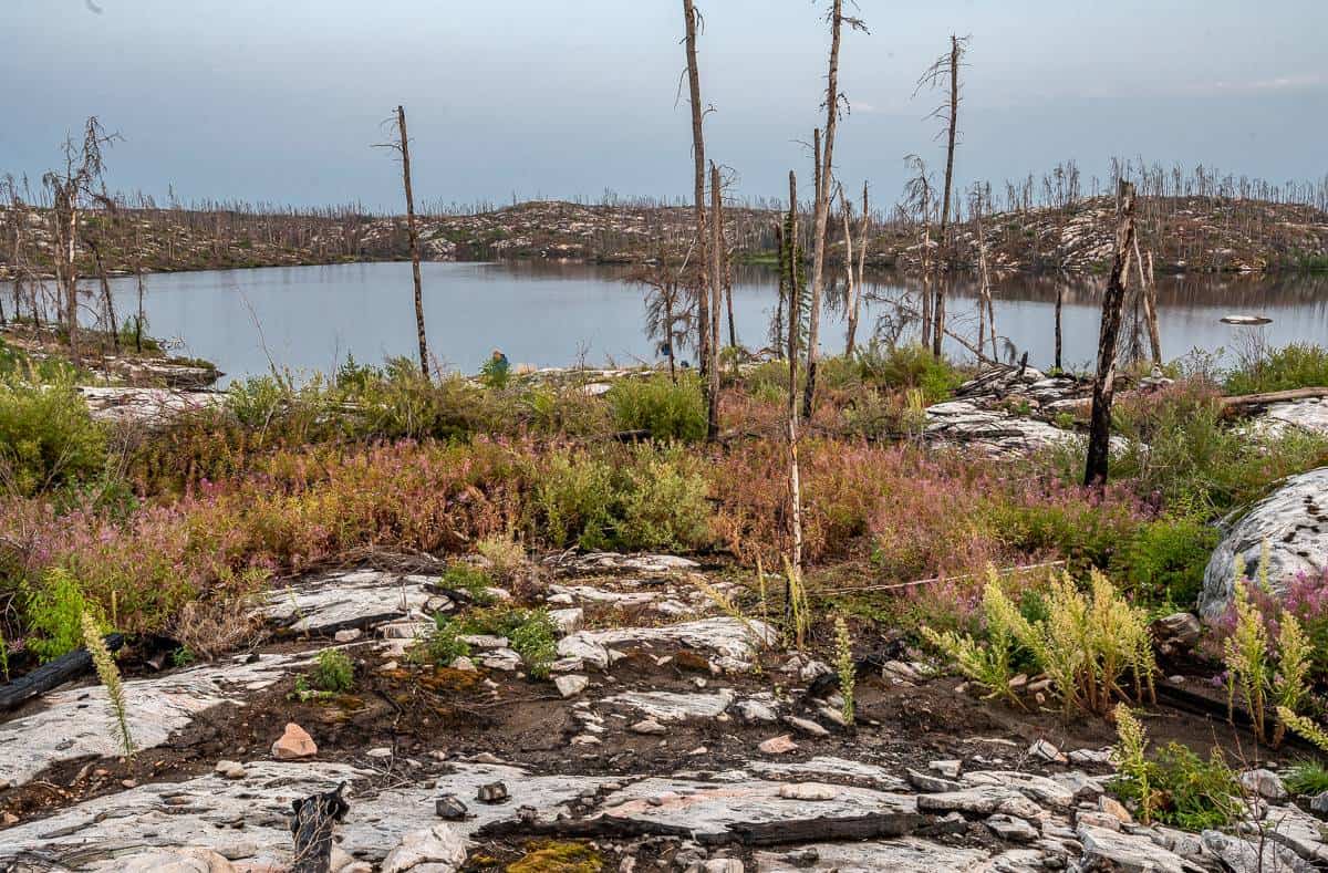
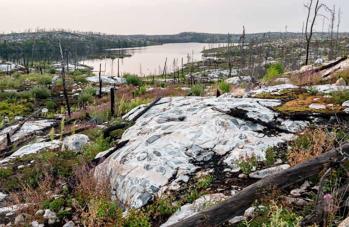
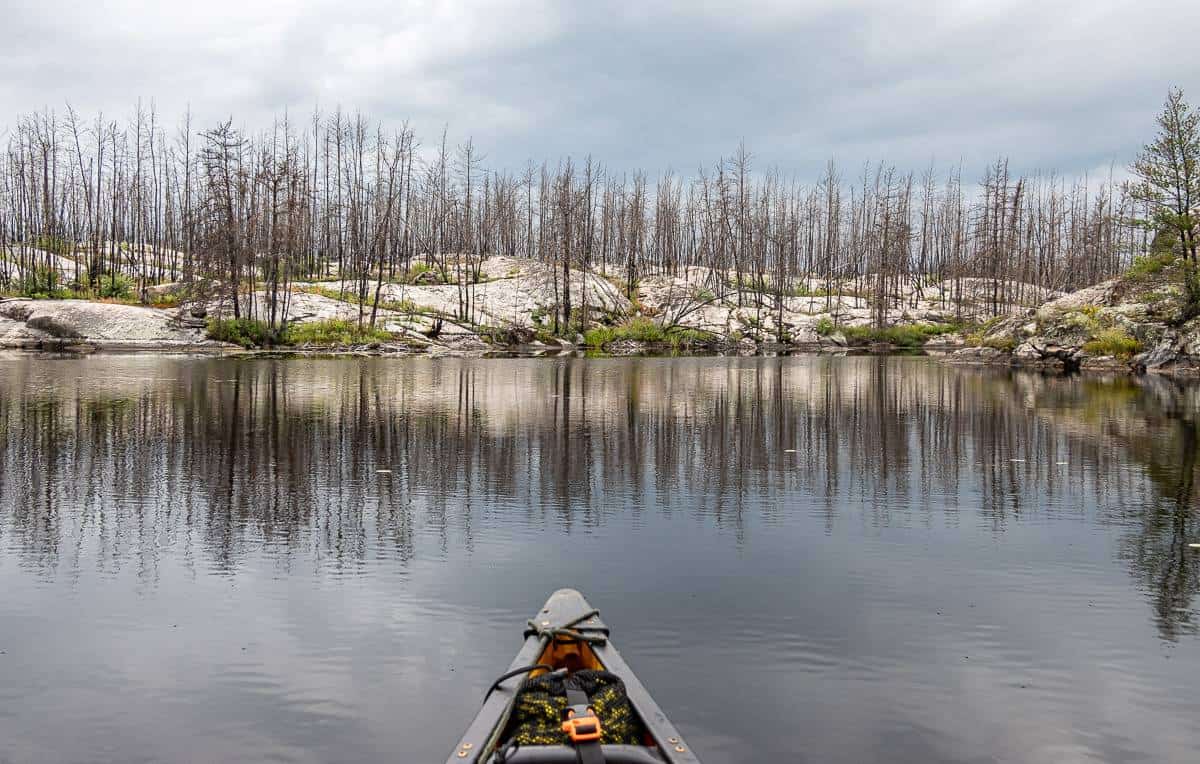
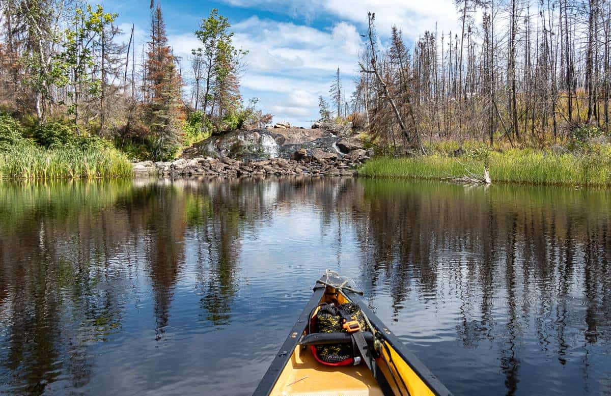
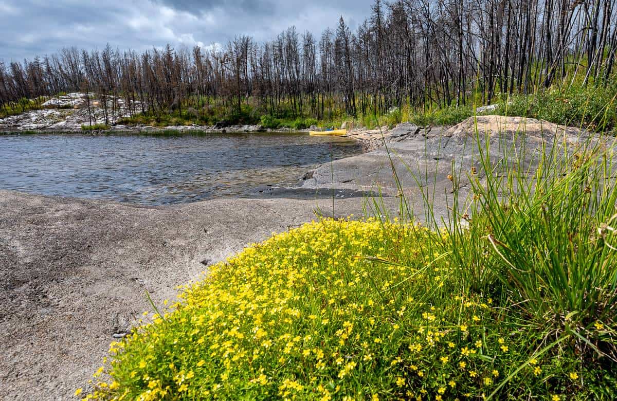
In the summer of 2021, roughly 55% of Woodland Caribou Provincial Park was burned as you can see on the fire boundary map. If you look at the burn severity map you might be dissuaded from paddling here. But, the on the ground reality is very different. About two thirds of our canoe trip in Woodland Caribou was in the burn – and I can honestly say that I found it more interesting to paddle through charred trees than green trees.
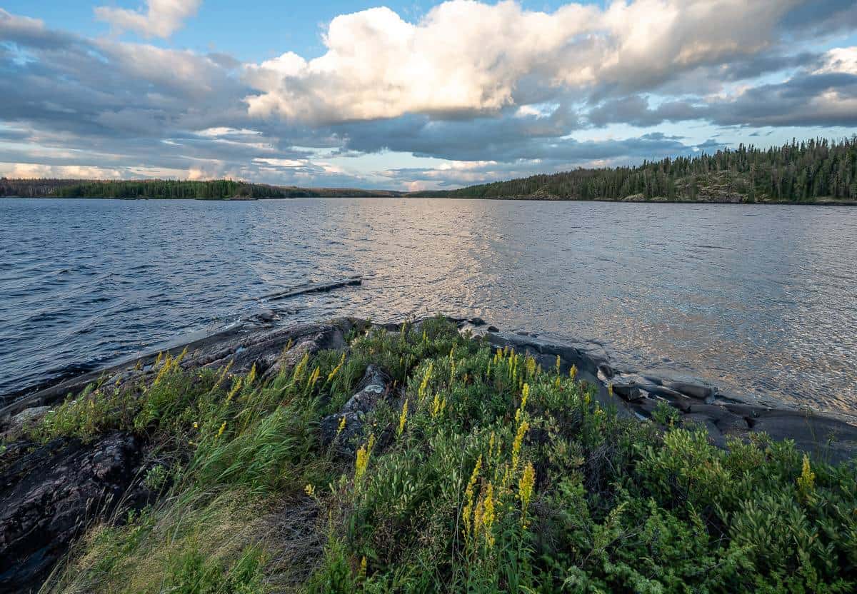
In the two years since the fire there has already been tremendous regrowth. Pink fireweed and many other types of wildflowers are everywhere. Some conifers are already six feet tall. Great swaths of granite outcrop have been exposed – so you now enjoy blasts of red, pink and white rock visible where none was before. You can see much further too – so birds and wildlife are easier to spot.
One downside to the burn is that some of the portages are hard to navigate. The park is doing the best it can with limited resources marking the portages in the burn with flagging tape and cutting trees that are hazards at campsites and along the portages. But this is a huge park, so if you go off the main routes, you need to be prepared for route finding through burned areas. And don’t put your tent beside a tree that could come down in a wind storm.
Before you go to Woodland Caribou, check the status of forest fires in Ontario in case there are travel restrictions in place. Should there be a fire ban, be sure to pack fuel and a stove. If you make a campfire, be sure it is 100% out before continuing on your canoe trip.
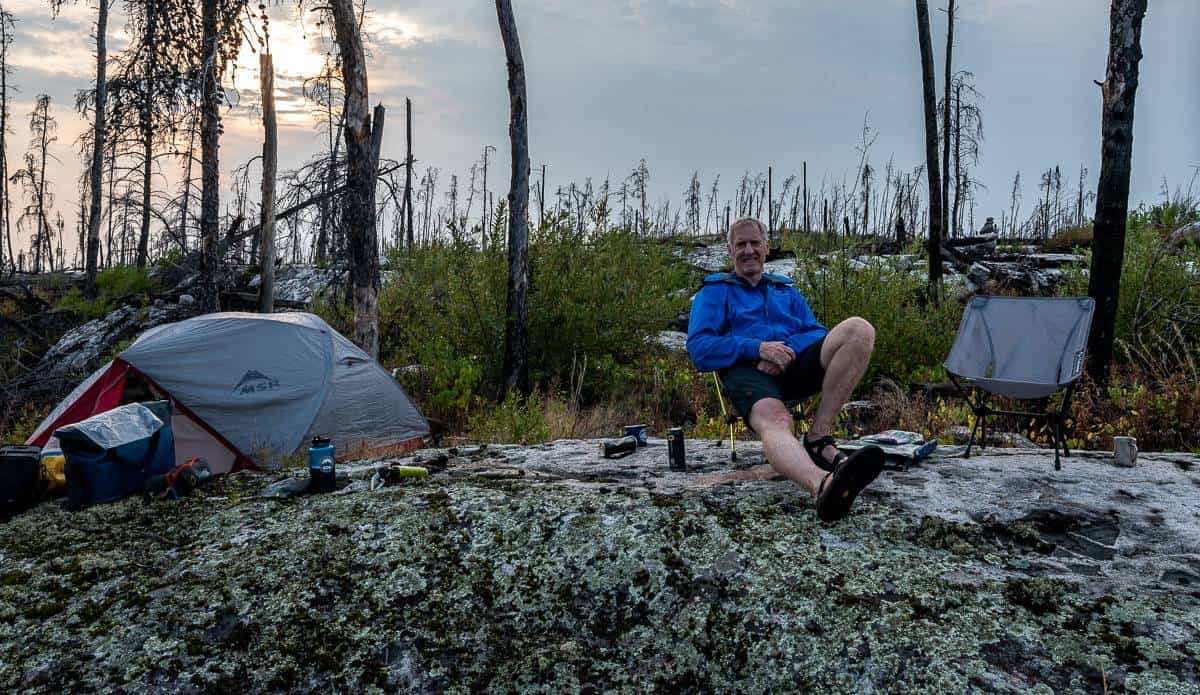
Camping in Woodland Caribou
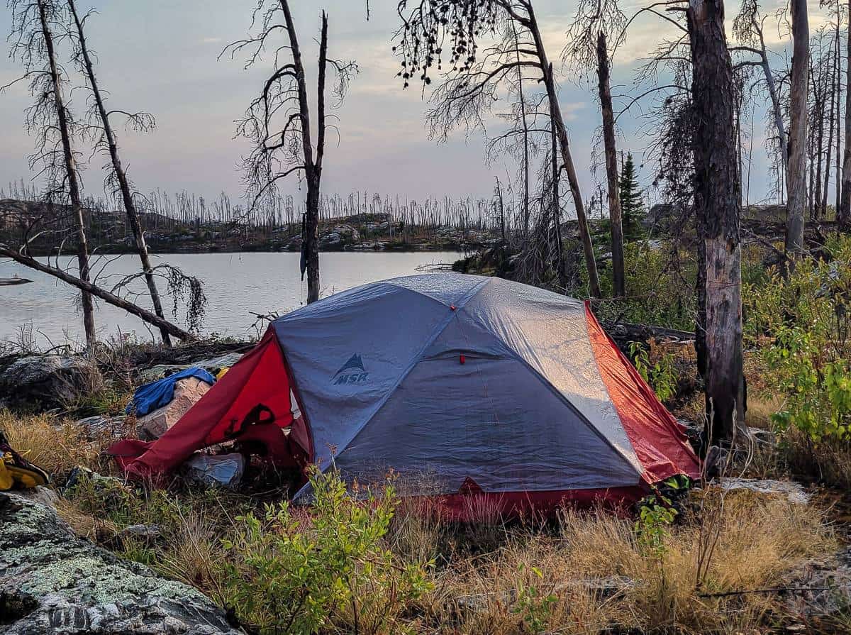
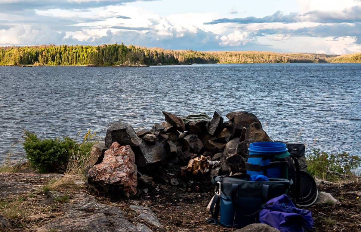
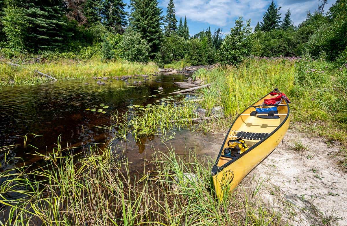
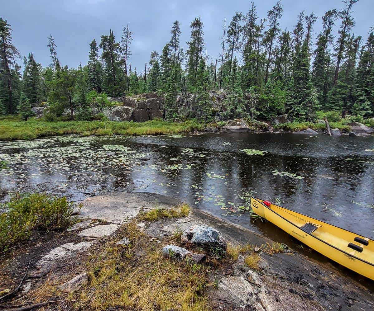
It didn’t take long to figure out what a backcountry campsite looked like. Every one of the ones we stayed at sported a stone fire ring that you could usually see from the canoe. Some had benches set up – though that isn’t allowed.
All of the campsites save for one on Telescope Lake were in great shape. Someone there had defecated, and left a big pile of poop with massive amounts of toilet paper. Please, do not be that person. Dig a hole and bury your poop. Pack out what you pack in – and leave no trace. Better yet, pick up anything you find, so the campsite is in even better shape than you found it.
History of Woodland Caribou Provincial Park
The history of the Woodland Caribou region is painted on its walls in red ocher. Pictographs from the Ojibway occupation of the area in the centuries before European exploration decorate the rock cliffs of Woodland Caribou Park in unmatched fashion. The Bloodvein River, a Canadian Heritage River that flows through Woodland Caribou and adjacent Akikaki Provincial Park in Manitoba is known not only for its whitewater, but also its pictographs and archaeological sites.
Ecology
The climate in Woodland Caribou is hotter and drier than in the popular canoeing areas to the east. The dry climate, combined with Woodland Caribou’s well-drained plateau topography and its proximity to the western prairies creates a unique prairie-boreal ecosystem. Nearly 100 plants of the drier prairie habitats make a home in the park.
The park, as its name implies, also features a creature of the north–the woodland caribou. The park boasts the largest population of the shy ungulate south of the Hudson Bay lowlands.
Route for our one week canoe trip in Woodland Caribou Provincial Park
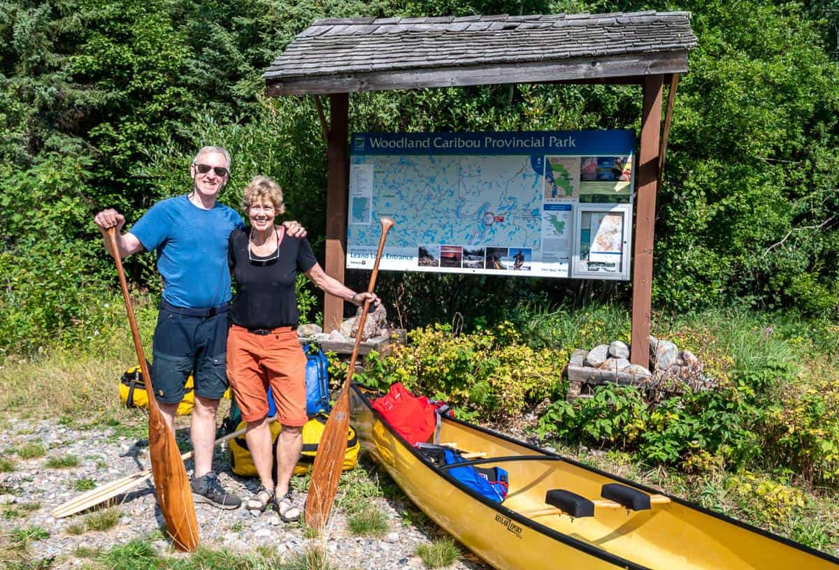
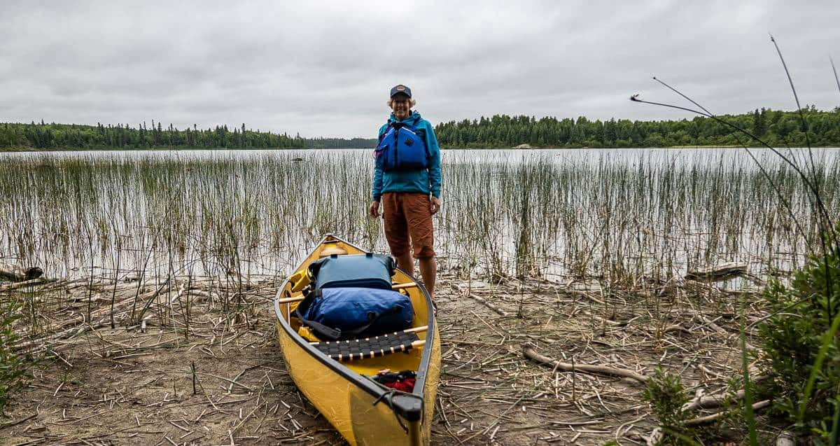
We took the advice of Walter from Goldseekers Canoe Outfitters and planned a trip that started at Leano Lake and ended at Onnie Lake – so shuttles were easy to do from Red Lake.
Described below is a day to day breakdown of our canoe trip in Woodland Caribou.
Day 1: Leano Lake parking lot to Upper Kilburn Lake campsite
Distance: 13.2 km including the portages.
Portages: Six totalling 2,025 m one way. (We did all portages three times = 6,075 m.)
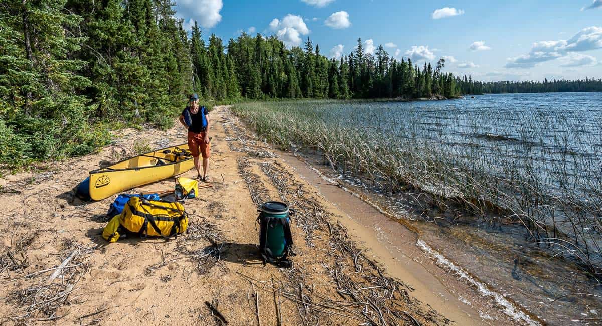
The first day out on a canoe trip is all about getting into the rhythm of being out on the water, checking the wind, making the call on when to stop – and picking a campsite.
From the Leano Lake parking lot you start with an easy 350 m portage that puts you on Leano Lake. It was here we ran into a father and son just coming off a trip to Mexican Hat Lake – a popular destination, in spite of the number of portages to get there. The dad warned us about two things – wildly slippery rocks and bees/wasps. We did see bees every day – but they never bothered us. I gave the wasps a wide berth and after the first campsite we never saw them again.
The paddle on Leano Lake was perfect – blue sky, sunshine and no one around once we left the beach. In short order we had a 400 m, 125 m and 50 m portage which slows you down. Then a pretty unnamed lake, another 100 m portage and we were into Kilburn Lake. The last portage was the longest of the entire canoe trip in Woodland Caribou – coming in at a kilometre. But we wanted it behind us. Then we found a beautiful campsite on Upper Kilburn Lake in an area that hadn’t been burned – but looked across to one that had.
The highlight here was waking up to 16 loons singing their heart out. I was told by Claire from Goldseekers that when loons congregate, it’s a sign that they are getting ready to leave.
Day 2: Upper Kilburn Lake campsite to the 425 m portage on the Paull Lake system
Distance: 18.7 km including the portages
Portages: nine totaling 1,180 m one way
Day 3: Paull Lake System to Mexican Hat Lake
Distance: 20.9 km including portages
Portages: 6 totaling 1,830 metres
Day 4 canoe trip in Woodland Caribou: Mexican Hat Lake to Glenn Lake
Distance: 15.4 km including portages
Portages: 3 totaling 300 m
Day 5: Glenn Lake to Telescope Lake
Distance: 12.6 km i8ncluding portages
Portages: Five totaling 730 m; total distance walked = 2,190 m
Day 6: Telescope Lake to the Onnie Lake parking lot
Distance: 14.2 km including portages
Portages: 7 totaling 1,630 m
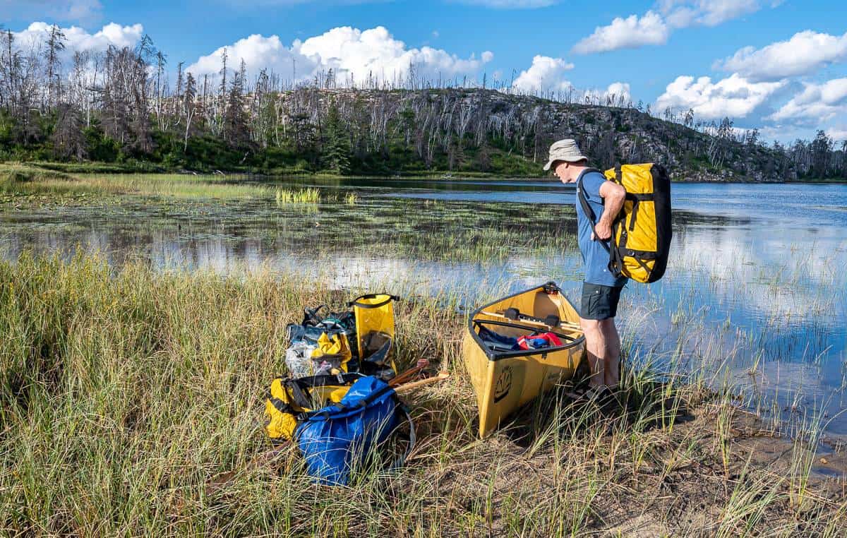
Camping equipment
The following are a few things we brought with us that were very helpful.
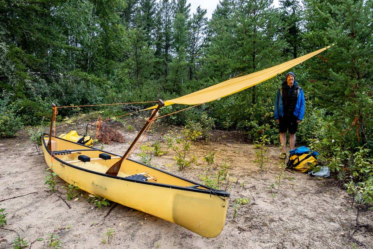
The MEC Silicone Scout tarp is lightweight and packs into nothing. On our second day out we wrapped it over our heads while we sat on our camp chairs waiting out a thunderstorm for 75 minutes. It helped keep us warm. Another time we set it up over our tent in case it rained. And when John couldn’t find his rain pants on the last day, he put the tarp over his legs – again to help stay warm.
What I liked about the tarp – the nickel plated solid brass grommets that prevented tearing and the grommet in the middle of the trap so you can suspend the tarp like a pyramid.
Permits for a canoe trip in Woodland Caribou Provincial Park
Permits are required for backcountry camping in Woodland Caribou Provincial Park. Ontario Parks notes that all fees collected by the park are used exclusively by Ontario Parks. Permits are also required for day-use and for frequent visitors to the park.
Permit and Fee information [pdf]
Permits can be obtained from:
(1) NEW – online permitting now available: https://reservations.ontarioparks.com/backcountry
(2) local canoe outfitters
(3) by mail from Woodland Caribou Provincial Park (P.O. Box 5003, Red Lake, Ontario, P0V 2M0)
(4) by phone via Point-of-Sale Service from the Ontario Parks office during business hours (Visa, Master Card, Tel: (807) 727 1329
(5) over the counter from the Ontario Parks office in Red Lake during business hours (8:30am to 4:30pm, Monday through Friday)
(6) from the self-serve station located outside the Ontario Park office
Fishing
The one canoeist we met on our trip had come up from the US to fish and canoe. His dream was to do both at the same time, but in short order he discovered the winds weren’t working in his favour.
Woodland Caribou is a destination for avid fisherman with its pristine waters and the small amount of fishing that actually happens. You will need an Ontario fishing license. The three fish to catch are lake trout, walleye and pike. We didn’t bother fishing on this trip, but if you’re going out for a long time, it would be a great way to supplement your diet.
More canoe trips in Canada your might enjoy
- A Week Long Canoe Trip in Quetico Provincial Park
- A 3-Day Algonquin Park Canoe Trip
- Powell Forest Canoe Route in BC – A Complete Guide
- Reindeer Lake Canoe Trip in Saskatchewan
- Canoeing the Caddy Lake Tunnels in Whiteshell Provincial Park, Manitoba
Click on the photo to bookmark to your Pinterest boards.