Glacier National Park, located in the Selkirk and Purcell Mountains of southeastern British Columbia, is one of Canada’s outstanding parks for hiking. It features lush old-growth rainforest, alpine terrain, and a dizzying number of mountain peaks and glaciers that are surprisingly accessible on foot.
Trailheads are easy to access from the Trans-Canada Highway between Golden and Revelstoke. While there are no services in the park, there are two front-country and two backcountry campgrounds. Some campsites are available on a first-come, first-served basis.
In this hiking guide, I cover the best day hikes in the park, including trailhead locations, distances, elevation gains, difficulty ratings and suggested places to stay either in or near the park.
This post includes affiliate links. If you make a qualifying purchase through one of these links, I will earn a small commission at no extra cost to you. Thank you for supporting my website.
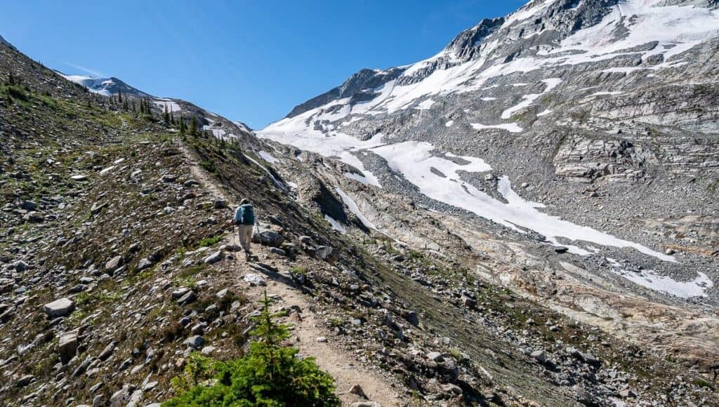
On the way to the Asulkan Hut
Glacier National Park Hiking: What You Need to Know
Best Time to Hike
To avoid disappointment, plan to hike the trails in Glacier National Park between July and September. By the end of September, temporary bridges found on some trails are removed for the winter.
Trails are usually snow-free from early July until mid to late September, but in years with heavy snowfall, snow can linger at higher elevations.
Before you head out, check Glacier National Park trail reports for updates on conditions and closures. Trails can also close for short periods because of bear activity.
Bear Safety
Grizzly bears are commonly seen in Glacier National Park, so it’s very important that every adult carries easily accessible bear spray – and knows how to use it. Read my Tips for Staying Safe in Bear Country, so you know what to do if you encounter a bear.
Trailhead Locations
Many of the trails in Glacier National Park start near the Illecillewaet Campground. However, some are accessed at different points along the Trans-Canada Highway, including the Hermit Trail.
You can purchase a map at the Rogers Pass Centre in Glacier National Park to help you locate a trailhead, or research trail locations online ahead of time. It’s especially important in this park to know where you’re headed because traffic moves quickly – and there may be a big truck on your tail.
What to Pack
Bear spray: Every adult should carry easily accessible bear spray and know how to use it.
Navigation: Download an offline map using Organic Maps, and consider carrying a paper map.
Water: Carry at least two litres of water, or a collapsible water bottle with a filter like this one I use by Katadyn.
Clothing: Pack multiple layers, including a warm layer and rain protection. Mountain weather can change quickly.
Sun protection: Pack a wide-brimmed sun hat or ball cap and apply sunscreen a couple of times a day.
Insects: Bring some insect repellent in case the bugs are bad.
Hiking poles: Collapsible hiking poles can be helpful on the steep ascents and descents.
The 10 essentials: Carry a first-aid kit, headlamp, emergency shelter, extra food and the other hiking essentials.
Footwear: Comfortable and supportive footwear is essential.
Parks Canada wildlife sightings board near the Illecillewaet trailhead in Glacier National Park
Best Hikes in Glacier National Park, BC
From short rainforest walks to challenging alpine ridges and glacier viewpoints, these are the Glacier National Park hikes I’ve personally done.
People near the end of Abbott Ridge on a smoky day
Best Easy Hikes in Glacier National Park
Hemlock Grove
Be wowed by towering trees on this short interpretive boardwalk trail.
Distance: 350 m loop
Elevation: Minimal
Time needed: 15 min
Terrain: Boardwalk
Trailhead: Hemlock Grove Day Use Area
You only need about 15 minutes to do the easy walk along the Hemlock Grove Interpretive Trail. It’s a particularly good stop if you’ve been driving for some time and need to stretch your legs.
The Hemlock Grove Boardwalk is a legacy of Rick Hansen’s 1987 Man in Motion World Tour. It’s a barrier-free experience, accessible to those with limited mobility or visual impairments. Along the 350-metre loop, you’ll learn a thing or two about the only inland hemlock-cedar rainforest in the world. Be sure not to touch the devil’s club!
Enjoying the short easy hike along the Hemlock Grove Boardwalk
Some of the extra tall hemlock trees along the Hemlock Grove Boardwalk
Rockgarden
A quick stretch-your-legs and get a bit of a view kind of hike.
Distance: 430 m loop
Elevation: Minimal
Time needed: 30 min
Terrain: Natural with slippery boardwalk (when wet), uneven stepping stones
Trailhead: 1.5 km east of Hemlock Grove Day Use Area
Another short trail that’s good for stretching your legs is the Rockgarden Trail. While still relatively easy, it’s more difficult than the Hemlock Grove Trail. Be prepared for slippery sections and some climbing between the lichen- and moss-covered boulders. Sturdy footwear is recommended.
Near the end of the loop there is a good view of the nearby glaciers and peaks – but you need a clear day to appreciate it.
Hiking through big boulders in the Rockgarden
There is a good trail through the Rockgarden
Moderate Hikes in Glacier National Park
Great Glacier
A great choice if you’re short of time, this hike climbs into the alpine, with waterfalls, some prominent mountain peaks and views of the Vaux Glacier.
Distance: 8.4 km return
Elevation: 320 m (1,050 feet)
Time needed: 2.5 hours
Terrain: Moderately steep natural trail and rock
Trailhead: The parking lot at Illecillewaet Campground
If you’re short on time but want a taste of what hiking in Glacier National Park is like, do the Great Glacier Trail. Named for what is now the Illecillewaet Glacier, it has been a famous landmark since the 1880s. Back then, you could do a short hike from Glacier House to the toe of the glacier. Since then, it has receded more than 1.5 kilometres, so you won’t even see it from the trail now.
The moderately difficult Great Glacier Trail climbs through pretty forest to a rocky endpoint, where you can enjoy great views of Mount Sir Donald and the Vaux Glacier. It’s a good hike, but it might leave you wanting more.
Gorgeous hiking on a moss-lined trail beside towering hemlocks
Waterfalls and mist at the end of the Great Glacier Trail
Marion Lake
A good choice on a hot day when you’re short on time but still want a taste of Glacier National Park’s mountain scenery.
Distance: 6.4 km return
Elevation: 425 m (1,384 feet)
Time needed: 2.5 hours
Terrain: Hard-packed dirt and rocky trail
Trailhead: The parking lot at Illecillewaet Campground
It’s a steep hike through the forest to reach Marion Lake. There’s more traffic on this trail than you might expect because it’s the first leg of the Abbott Ridge hike.
Marion Lake itself is very pretty and makes a good destination if you’re short on time. There’s reportedly a short spur trail to a viewpoint over the Trans-Canada Highway. Although I haven’t hiked it, you can watch trains entering and leaving the Connaught tunnel, which was built in 1916 to protect trains from avalanches.
The trail to Marion Lake starts off steeply
Reflection in Marion Lake
Difficult Hikes in Glacier National Park
Hermit Trail
A steep, rugged climb through subalpine forest and rocky terrain to a spectacular alpine basin beneath Mount Tupper.
Distance: 6.4 km return
Elevation gain: 819 m (2,687 feet)
Time needed: 3-4 hours
Terrain: Loose dirt, rocks, rock slabs and engineered stone steps
Trailhead: Approximately 1.5-1.6 km east of the Rogers Pass Discovery Centre, and about 70 km west of Golden. It’s here on Google Maps.
The Hermit Trail hike is commonly considered to be the steepest hike in Glacier National Park. But it’s also a very doable hike on a good trail, and there’s nothing technical to worry about. The trail starts climbing after just a few hundred metres – and doesn’t let up. Hike through sub-alpine forest past large trees to reach a more open, rocky area. Continue climbing through well-placed boulders and scrambling up a couple of short rope sections to reach Hermit Meadows.
At the top, you can simply wander around and explore, or find a rock with a view and enjoy your lunch. You can also spend a night here at the popular backcountry campground. While it’s a serious workout, the views and scenery make the hike very worthwhile.
A grand view from the Hermit Meadows Trail
The steep descent from Hermit Meadows
Abbott Ridge
The park’s most popular hike, with varied terrain underfoot and a spectacular finish on a narrow ridge with grand glacier and mountain views.
Distance: 15.6 km return
Elevation: 1,030 m (3,379 feet)
Time needed: 6.5 hours
Terrain: Hard-packed dirt, grass, and a rocky trail
Trailhead: The parking lot at Illecillewaet Campground
The hike up Abbott Ridge is the most popular hike in Glacier National Park – and for good reason. There’s a lot of variety on this full day hike, from ancient rainforest to alpine tundra, with a finish on a narrow ridge that feels more like a mountain-top. There is also the option of doing a loop hike after Marion Lake.
There are no route-finding issues or scary moves required, but you do need the endurance to climb and descend 1,030 metres. From Abbott Ridge, the views are sublime. Mount Sir Donald stares you in the face, but you’ll also see everything from the Trans-Canada Highway to Asulkan Valley, Asulkan Glacier, Illecillewaet Glacier, Vaux Glacier and beyond.
If you only have time for one big hike in the park, make it Abbott Ridge.
It’s a very rocky hike on the way up to Abbott Ridge
Hiking on Abbott Ridge
Avalanche Crest
A scenic hike to a high point overlooking Rogers Pass and the Trans-Canada Highway with sweeping glacier views in all directions.
Distance: 10.2 km return
Elevation: 795 m (2,608 feet)
Time needed: 5-6 hours
Terrain: Forest, alpine terrain, a dramatic ridge
Trailhead: Illecillewaet Trailhead
The difficult hike up Avalanche Crest is well worth the effort for the expansive views at the top. The hike starts with a climb through a beautiful old-growth forest filled with awe-inspiring trees. A short section of subalpine wildflower-filled meadows is next. It ends at a basin and from there it’s a short climb to a ridge. Follow it to a sign marking the end point, the ideal place for lunch.
The views from the top of Avalanche Crest are magnificent. You can see Rogers Pass and the Trans-Canada Highway thousands of feet below. In every direction you’ll see glaciers, and you’ll be able to pinpoint many of the other hikes in the park. What sets this hike apart from many others is how quiet it is. We only saw a handful of people on a beautiful summer’s day.
Looking way down to the Trans-Canada Highway from the top of the Avalanche Crest Trail
Stunning glacier views everywhere you look from the top of the Avalanche Crest Trail
Glacier Crest
An ambitious hike that rewards with up-close glacier and mountain views.
Distance: 13.4 km return
Elevation: 960 m (3,150 feet)
Time needed: 6-7 hours
Terrain: Forest trails, hard packed and rock slabs
Trailhead: By the Illecillewaet Campground
The Glacier Crest Trail is a very rewarding hike thanks to close-up views of the Illecillewaet Glacier and a mountain landscape that includes Abbott Ridge, Perley Rock and the Rogers Pass summit. It’s a stiff climb to reach the rocky ridge separating the Asulkan Glacier and Illecillewaet Valley, but between beautiful hiking through ancient forest and increasingly impressive mountain and glacier views, this is one of the must-do hikes in the park.
More than any other hike I’ve done in the park, this one leaves you with a feeling that you can simply reach out and touch the massive Illecillewaet Glacier. It’s humbling and awe-inspiring. For some reason, this hike doesn’t see the foot traffic you’d expect.
View of the Illecillewaet Glacier from the Glacier Crest Trail
Glacier views on the way up to the top of the Glacier Crest Trail
Asulkan Valley to Asulkan Cabin
A long valley hike with a steep climb up a moraine near the end to finish at a mountain hut with big glacier and mountain views.
Distance: 15.8 km return
Elevation: 870 m (2,854 feet)
Time needed: 5.5-7 hours
Terrain: Rocky forest trail and a steep moraine
Trailhead: Illecillewaet Campground parking lot
The hike up the Asulkan Valley to the Asulkan Cabin parallels Asulkan Brook and initially offers views of waterfalls, mountains and sinuous moraine ridges. Make more noise than normal as you hike beside the brook. It’s noisy, and you want to alert any nearby bears to your presence.
After crossing Asulkan Brook, hike through one final section of forest before reaching a steep moraine. For the next 50 minutes, simply put one foot in front of the other. I highly recommend stopping every so often to catch your breath and take in your surroundings. The moraines are bigger than others I’ve seen, and the glacier and mountain views get better with every step.
Finish the hike by visiting the Asulkan Cabin. You can also stay overnight by making a reservation through the Alpine Club of Canada.
A view down the length of the Asulkan Valley
Quite the backdrop for the Asulkan Hut – at the end of the Asulkan Trail
More Great Hikes in Canada’s Western National Parks
I have spent a couple of decades hiking in the Rocky Mountain national parks – and while there will always be hikes on my wish list, these are some of my favourite collections of hikes across the region.
Best Hikes in Yoho National Park
Best Hikes in Banff National Park
Best Hikes in Kananaskis for Mountain Lovers
Best Hikes in Jasper National Park
Best Hikes in Waterton Lakes National Park
On the Skyline Trail in Jasper National Park
Camping in Glacier National Park, BC
Illecillewaet Campground
Illecillewaet Campground is an excellent base for exploring Glacier National Park, especially because it’s the starting point for many of the best trails in the park. The campground is a mix of reservable (30 sites) and first-come, first-served campsites (30 sites) for both tents and RVs.
Facilities include flush toilets, potable water, food lockers and kitchen shelters. Campfires are allowed with a fire permit. There is no electricity and showers are unavailable.
The campground and trailhead are located 3 km west of the summit of Rogers Pass. If you’re driving east, simply turn right onto the access road to the campground. If you’re driving west, you’ll need to drive past the campground for about a kilometre to reach a designated U-turn lane. Get in the far-left lane in advance (there’s a warning sign indicating the upcoming turn), make the U-turn, and drive east on the Trans-Canada Highway, turning when you see the campground signs.
The campground is open from June 19 – October 12, 2026 and reservations are taken between June 19 – September 19, 2026. (I will update the dates in December when Parks Canada releases 2027 dates.) You can book reservations online. If you don’t have any luck scoring a site, I highly recommend Schnerp – a company that scans for cancellations and notifies you when a campsite becomes available.
Campsite at the Illecillewaet Campground
Loop Brook Campground
Loop Brook Campground, located 2 km west of the Illecillewaet Campground, is smaller and more intimate. Guarding its entrance are grand old stone railway pillars. And beyond the campground you can hike the Loop Brook Trail and marvel at the well-preserved stone bridge piers.
The campground has 20 reservable sites and none that are first-come, first-served. If you want minimal highway noise, try to get a campsite as far back from the highway as possible. Facilities are the same at the Illecillewaet Campground – flush toilets, potable water, food lockers and kitchen shelters. There is no electricity or showers.
The campground was open from June 26 to September 21, 2026 and can be booked online.
My tent at Site #6 in the Loop Brook Campground
Backcountry Camping in Glacier National Park
There are two backcountry campgrounds in Glacier National Park, Hermit Meadows and Sir Donald Backcountry Campground.
Hermit Meadows
Hermit Meadows has 8 tent sites which can be reserved for a maximum of three nights. It was open from July 1 to October 1 and reservable from July 14 to September 14 in 2026 – but opening and closing dates are always snow-dependent. Outside of the reservation period, campsites are available on a first-come, first-served basis. Reserve online.
Facilities include tent pads, pit toilets and bear-proof lockers. No fires are permitted – so you will need to bring a gas stove. Mountain goats have been visiting the campground – and they seem to have an affinity for urine and sweaty items. Use the pit toilets and put sweaty items and gear in the bear-proof lockers.
Tent set up on wooden platforms at the Hermit Meadows Backcountry Campground
Sir Donald Backcountry Campground
The Sir Donald Backcountry Campground is open from July 1 until October 1, but dates are snow- -dependent. There are only four campsites, with permits available at the Illecillewaet Campground on a first-come, first-served basis ONLY. Facilities include pit toilets and bear-proof storage. Bring a gas stove, as campfires aren’t permitted.
Where to Stay Near Glacier National Park
Staying in Golden, BC
Golden is a one-hour drive from the Illecillewaet Campground, so it’s a good base if you want to go hiking, but prefer not to camp. Read my post on what to do in Golden before you go. It also includes restaurant suggestions.
There are lots of hotels, lodges, and even glamping tents in and near Golden. Some suggestions include the following:
Home Lodge is a luxury B&B with photogenic Scottish Highland cattle wandering through their spacious yard
The Blaeberry Base features two kitted-out geodesic domes with a full kitchen. Outside there’s a deck, a shared cedar sauna, a fire pit, a BBQ grill, and lots of green space.
Copper Horse Lodge up by the ski resort with spacious rooms and a sauna.
Holiday Inn – where you know what you’re getting.
The bedrooms at Home Lodge have a few Scottish touches
Staying in Revelstoke, BC
Revelstoke, about a 45-minute drive west of Glacier National Park, is also a convenient base for exploring the park. It has the added benefit of being close to Mount Revelstoke National Park, where you can enjoy some great hikes, including the hike to Eva Lake. And there are three hot springs in Nakusp worth visiting.
Revelstoke also has much to offer summer visitors. These 11 things to do in Revelstoke include rafting, paddleboarding and riding the Pipe Mountain Roller Coaster.
Some hotel suggestions include the following:
If you’re after a B&B experience, you’d do well to choose the Courthouse Inn Revelstoke.
Basecamp Resorts sits beside a river with mountain views and has two outdoor hot tubs.
Boulder Mountain Resorts has a little bit of everything, including glamping tents, log cabins, rustic glamping cabins, chalets and apartments.
Nearby Blanket Creek Provincial Park is a popular choice, thanks to its warm, man-made swimming lagoon. Martha Creek Campground, with its sandy beach and boat launch, is only a 20-minute drive from Revelstoke and would also be a great choice.
You can also camp at Snowforest Campground in Mount Revelstoke National Park. It’s only a five-minute drive from Revelstoke. It has 62 sites and three MicrOcubes, along with showers, electricity, potable water, lockers, and kitchen shelters.
Our cabin at Boulder Mountain Resort
Other Things to Do Near Glacier National Park
Visit the Rogers Pass Centre to learn about the history of the railway, the challenges of building through the mountains and the avalanche control program.
Explore Mount Revelstoke National Park, either by bike or on foot.
Enjoy the hiking and outdoor activities around Golden. Visit Boo the grizzly bear at the ski hill, walk with wolves, and explore a great selection of Golden area hikes.
If you have time, consider at least a day in Yoho National Park as part of a longer road trip. Visit Takakkaw Falls and walk around Emerald Lake.
Our walk-in campsite near Takakkaw Falls
Planning Your Visit to Glacier National Park
The trailheads around the Illecillewaet Campground in Glacier National Park can only be accessed by car. From Calgary it’s about a 3-hour-and-50-minute drive, a 45-minute drive from Revelstoke, and an hour’s drive from Golden. In summer, be prepared for some construction stoppages.
If you’re a keen hiker, you could easily spend five to seven days exploring the park. However, I think two or three days is ideal for most visitors, given the significant elevation gain on most hikes. That will give you a good taste of the beauty the park has to offer.
Suggested 2-Night, 3-Day Itinerary (for experienced hikers)
Day one: Arrive in the park by 10 AM and hike the Abbott Ridge Trail.
Day two: Hike either the Avalanche Crest Trail or the Glacier Crest Trail.
Day three: Do the shorter but steep hike to Hermit Meadows. Finish by early afternoon and continue on your way.
Final Thoughts on Hiking in Glacier National Park, BC
Glacier National Park in British Columbia flies under the radar of most hikers. People driving through the Rogers Pass area of the park have no idea of the beauty and the sheer number of glaciers and mountain peaks accessible from the highway. The hiking here is some of the best in Canada, with spectacular mountain and glacier scenery and surprisingly accessible trailheads.
View of a glacier near the Hermit Trail from the Avalanche Crest Trail
Explore More of British Columbia
Best Hikes in Vernon, BC: 14 Trails and Scenic Walks – Discover the best hikes in Vernon, BC, from lakeside walks and forest trails to panoramic viewpoints overlooking Okanagan Lake and Kalamalka Lake.
Castlegar to Revelstoke Road Trip: 15+ Stops Along the Way – A scenic Castlegar to Revelstoke road trip packed with over 15 stops, from waterfalls and hikes to quirky small towns in the heart of BC.
7 Things to do in Salmon Arm, British Columbia – Discover the best things to do in Salmon Arm, from lakeside walks and scenic viewpoints to local trails, markets, and fun small-town experiences.
Things to Do in Yoho National Park – A roundup of hikes, waterfalls, scenic drives, and outdoor experiences in one of Canada’s underrated national parks.
Things to Do in the Columbia Valley, BC & Nearby – A comprehensive guide to outdoor adventures, towns, and attractions in the Columbia Valley and surrounding area.
Click on the photo to bookmark to your Pinterest boards.
The post Best Hikes in Glacier National Park, BC + Where to Stay Nearby appeared first on Hike Bike Travel.