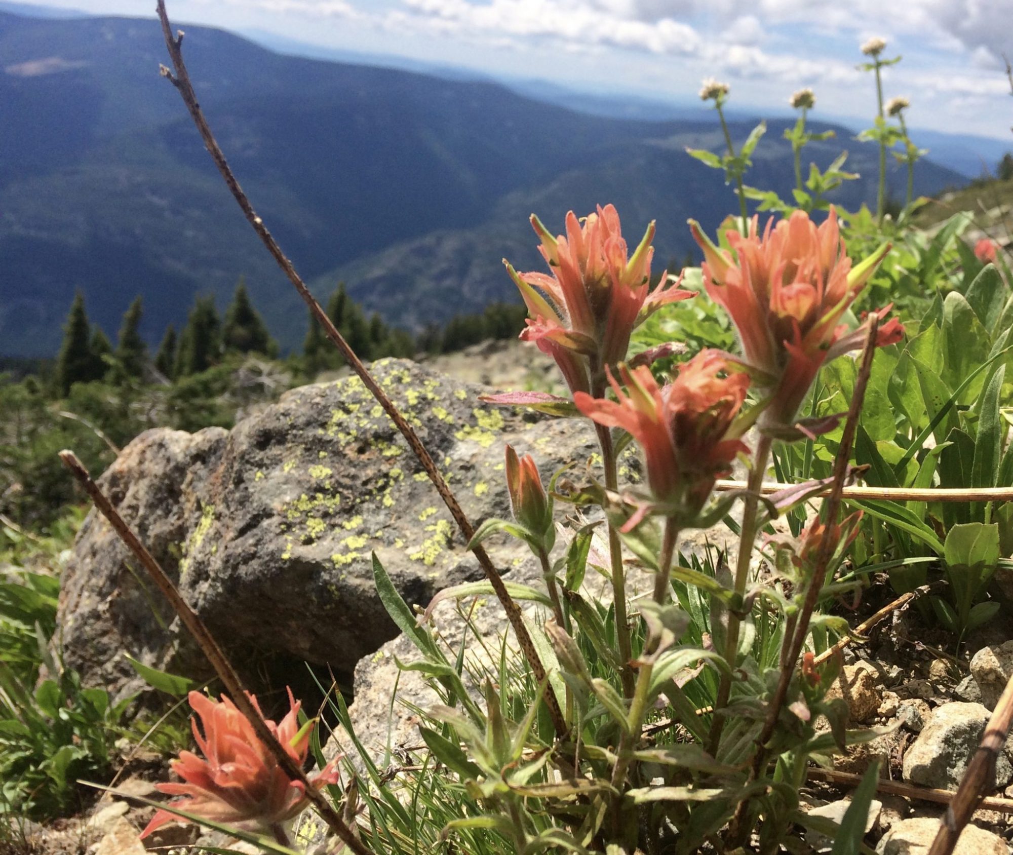
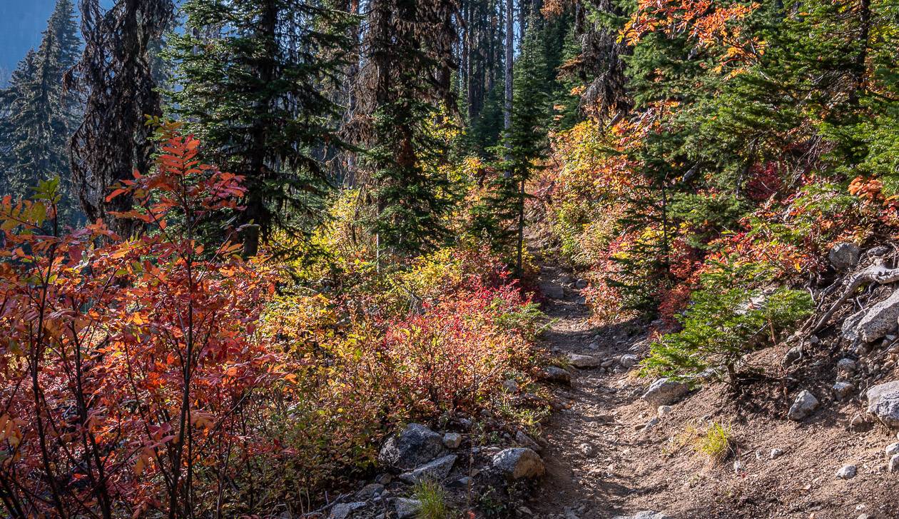
In the fall of 2022, I had the pleasure of spending three days in the Rossland area. One of the things I enjoyed most about my visit was the Old Glory Mountain hike – considered one of the top hikes in the Rossland area. It’s a long hard hike to the highest peak in the area – but it’s also very beautiful, especially in fall when the colours are peaking.
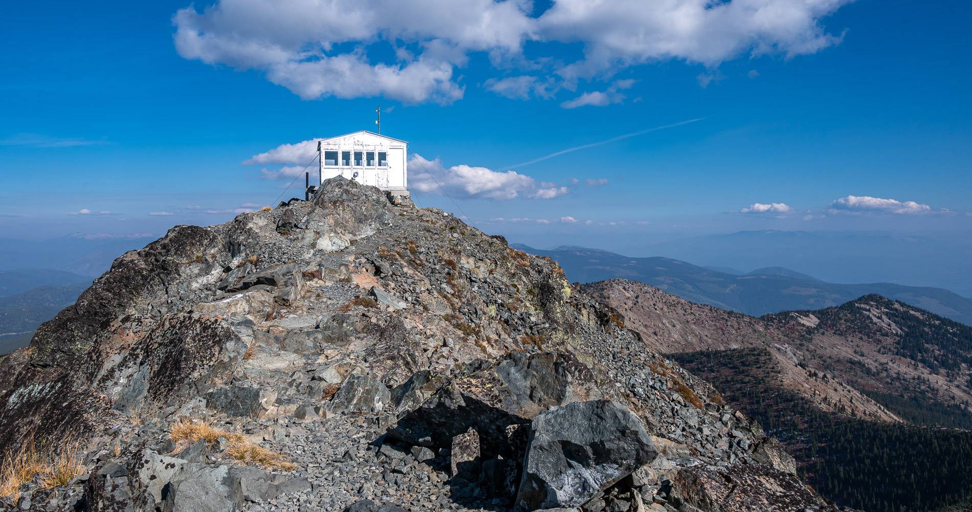
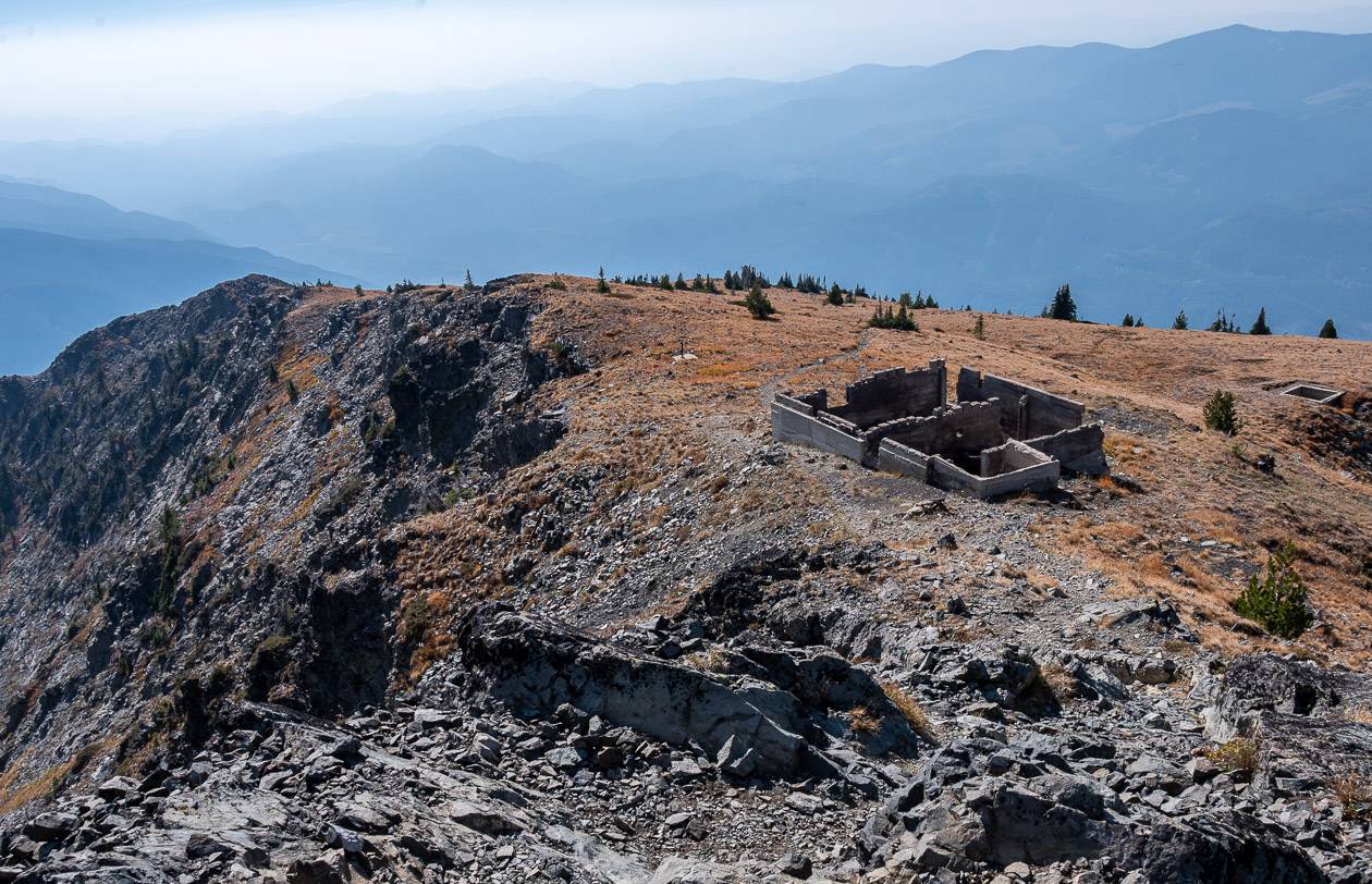
On the summit of Old Glory Mountain, you’ll find a decommissioned fire lookout cabin that once functioned as a weather station from the 1940’s to ’60’s. The forestry lookout and weather station cabin were manned for years by Wilfred and his wife Ruth Gifford. As forestry lookouts they spent 10 years in the Old Glory Lookout Cabin where Ruth was famous for whipping up huckleberry pies. At the trailhead there’s a very interesting sign explaining all that was required for them to live up there. Today apart from the cabin, there are rusted scraps like an old wringer washer, and a broken stone foundation.
You can check out my Instagram reel of the hike before you go.
This post includes some affiliate links. If you make a qualifying purchase through one of these links, I will receive a small percentage of the sale at no extra cost to you. Thank you very much for your support.
Old Glory Mountain hike summary
Distance: 15.6 km to 17.6 km depending what route you do
Elevation: Gain and loss of 1,145 m or 3,757 feet
Trailhead elevation: 1,390 m or 4,560 feet
Summit elevation: 2,376-m or 7,795 feet.
Difficulty: Hard because of the length and elevation gain but there is nothing technical on the Old Glory Mountain hike.
Time needed: 6.5 – 8.5 hours
Dogs allowed: Yes, but bring lots of water for them.
Don’t forget: The only water on the trail is at the beginning so be sure to carry upwards of 3 L per person.
Weather forecast: Check out the Red Mountain area forecast.
Trailhead access: Easy
Best time to hike: Mid- April through to October; the colours are amazing in October
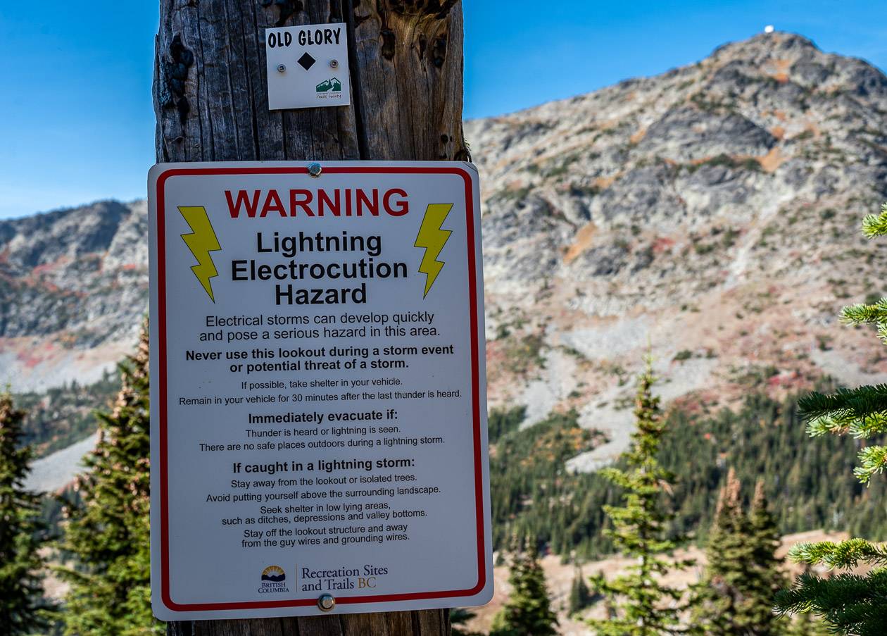
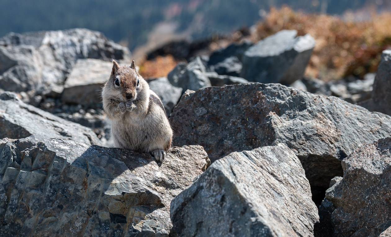
- This is bear country so make noise and carry bear spray. I put mine in a bear spray holster so I don’t set it off accidentally.
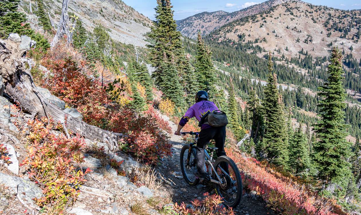
- You will share some of the Old Glory Mountain trail with mountain bikers doing the Seven Summits Trail. Be prepared to move out of the way quickly.
Old Glory Mountain hike trailhead
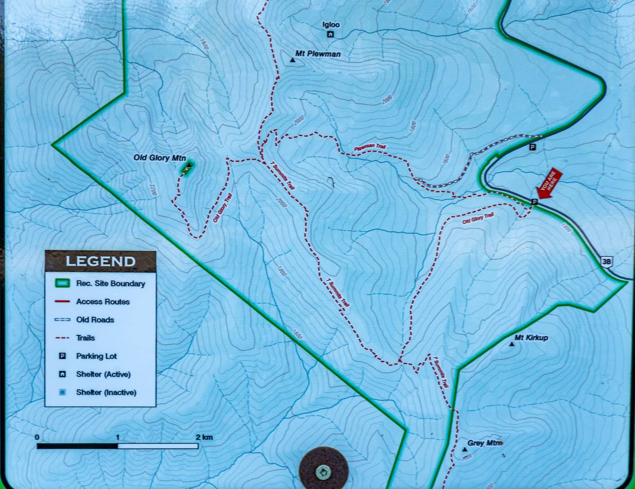
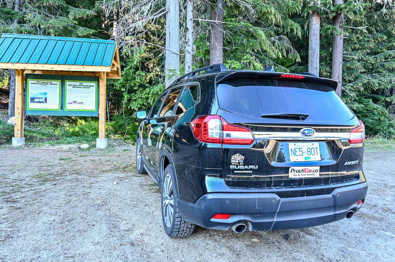
The Old Glory Mountain trailhead is off Highway 3B, 10.6 km north from the Rossland Museum. The parking lot is on the west or left-hand side of the highway. with a notice board with interpretive information and a map of the route.
Old Glory Mountain hike description
Old Glory Mountain is a full day hike. You can do it as a loop hike, heading 5.0 km up the steeper Plewman Trail and down 6.8 km on the gentler Old Glory – Seven Summits Trail. Or do and out and back on either trail but beware it’s along day no matter what route you choose, especially if it’s sunny and hot. From Unnecessary Ridge – where the Plewman and Seven Summits Trail meet, it’s still another 3 km up to the summit via a route that isn’t immediately obvious as it’s on the backside on the mountain where the grade is far gentler.
In total you will hike a minimum of 15.6 km return if you do an out and back via Plewman Ridge (which is what I did and I didn’t find it as steep as many reports suggested). If you hike up Plewman Ridge and down Old Glory, you’re looking at 17.6 km. Both routes have an elevation gain and loss of 1,145 metres or 3,757 feet. The trail is rated as difficult and requires 6 – 8.5 hours of hiking time.
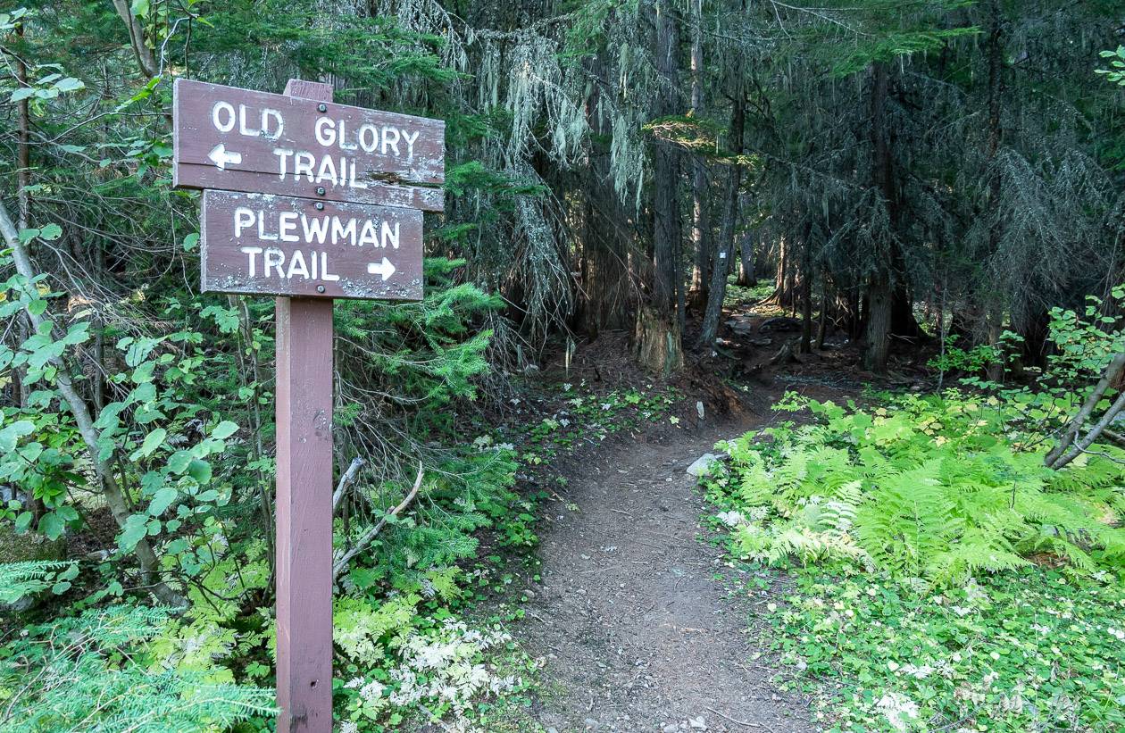
To start the Old Glory Mountain hike, walk uphill from the parking lot to reach a signed junction in about a minute – as pictured below. The most direct route to Old Glory Mountain is via the Plewman Trail.
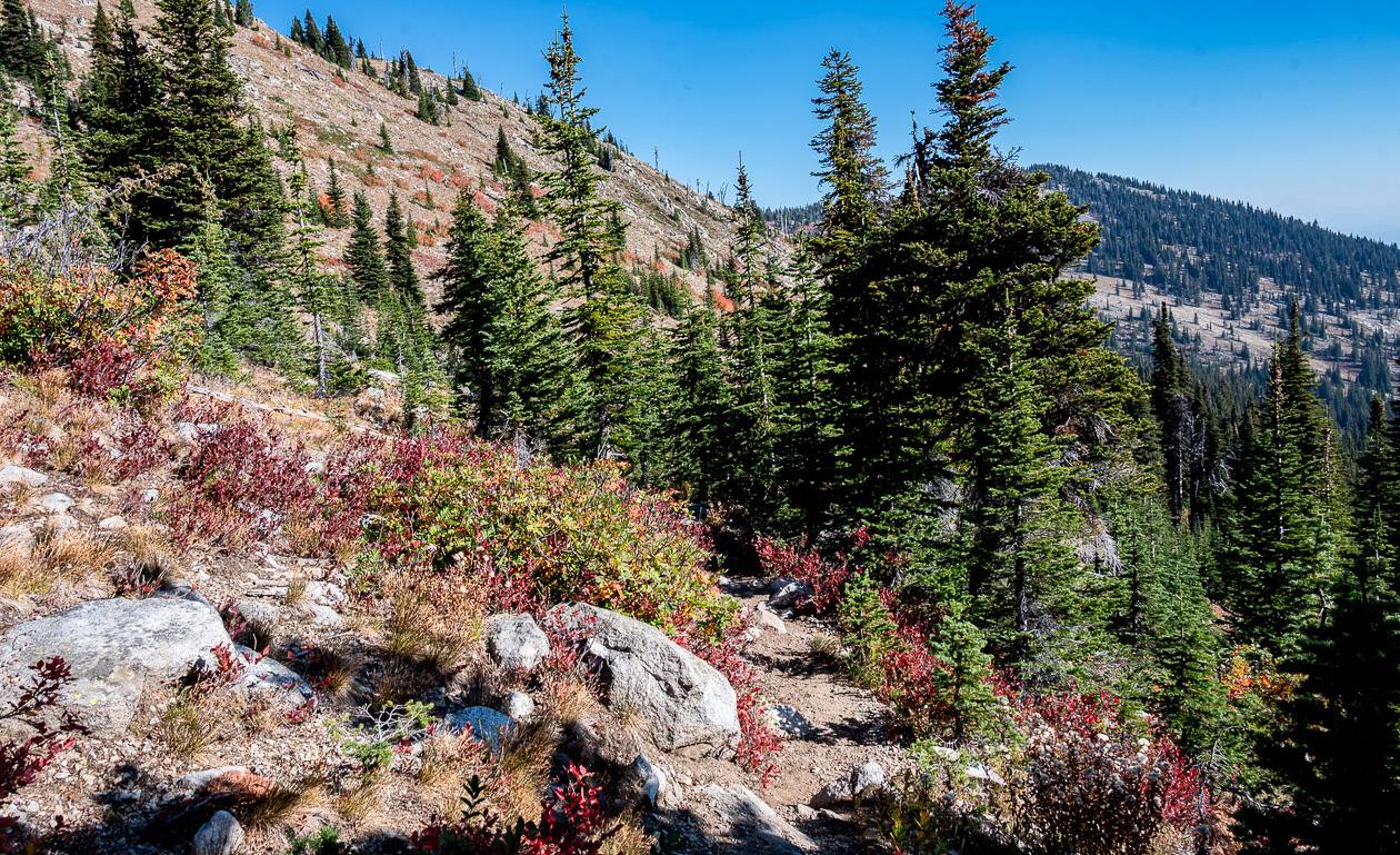
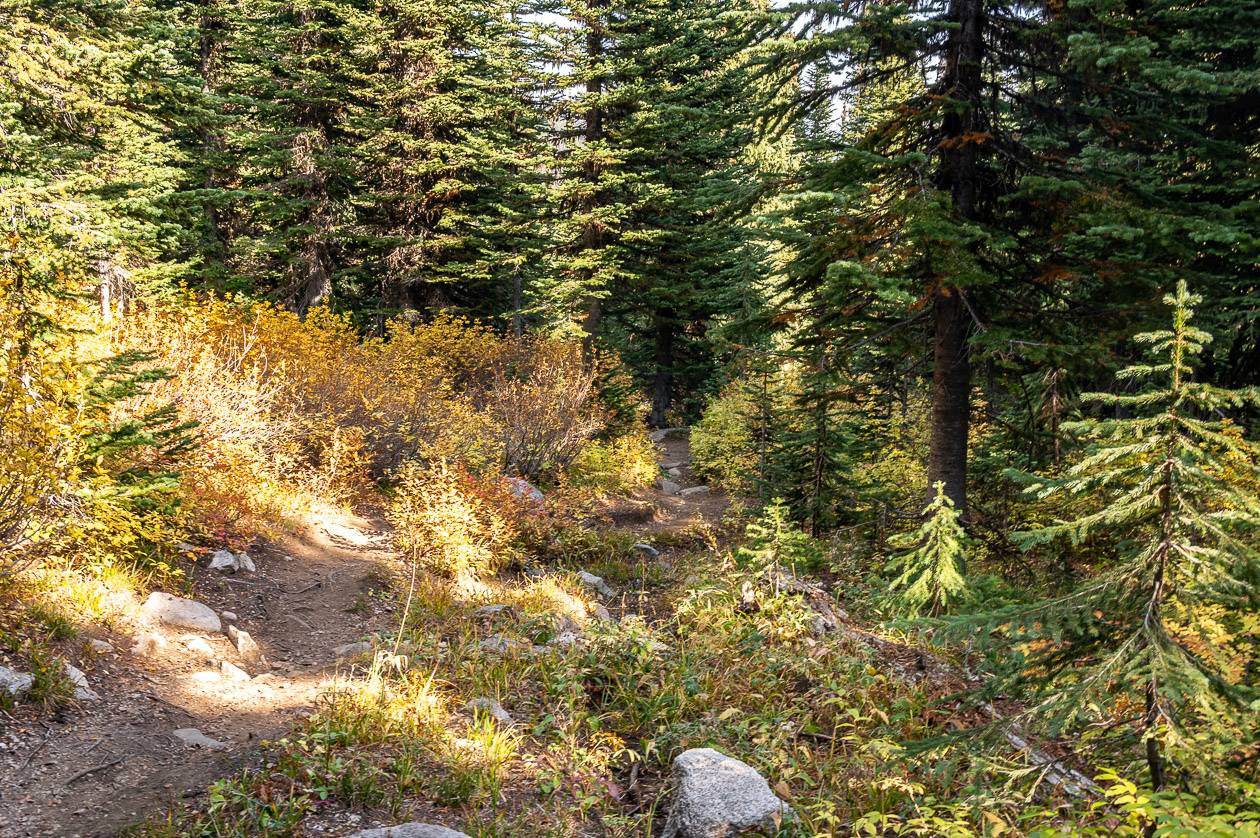
Follow the Plewman Trail past large trees, and an undergrowth thick with ferns. (Don’t take the road that drops down to the highway on your right after about 10 minutes of hiking.) The grade remains reasonable for some time as the trail runs parallel to the highway,
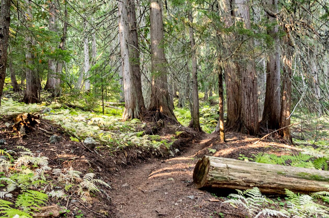
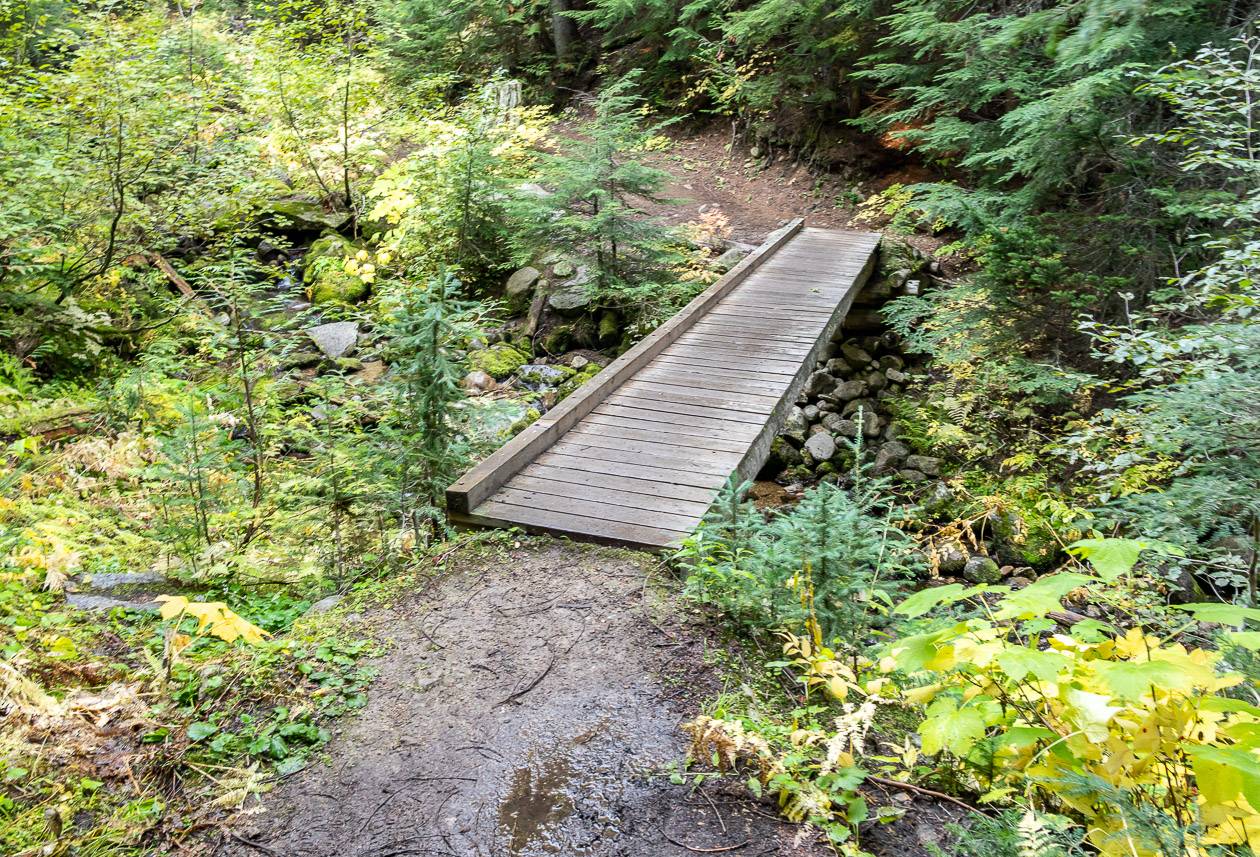
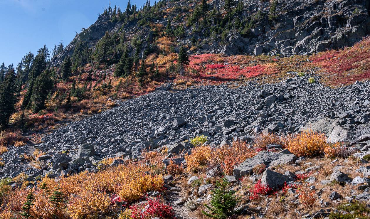
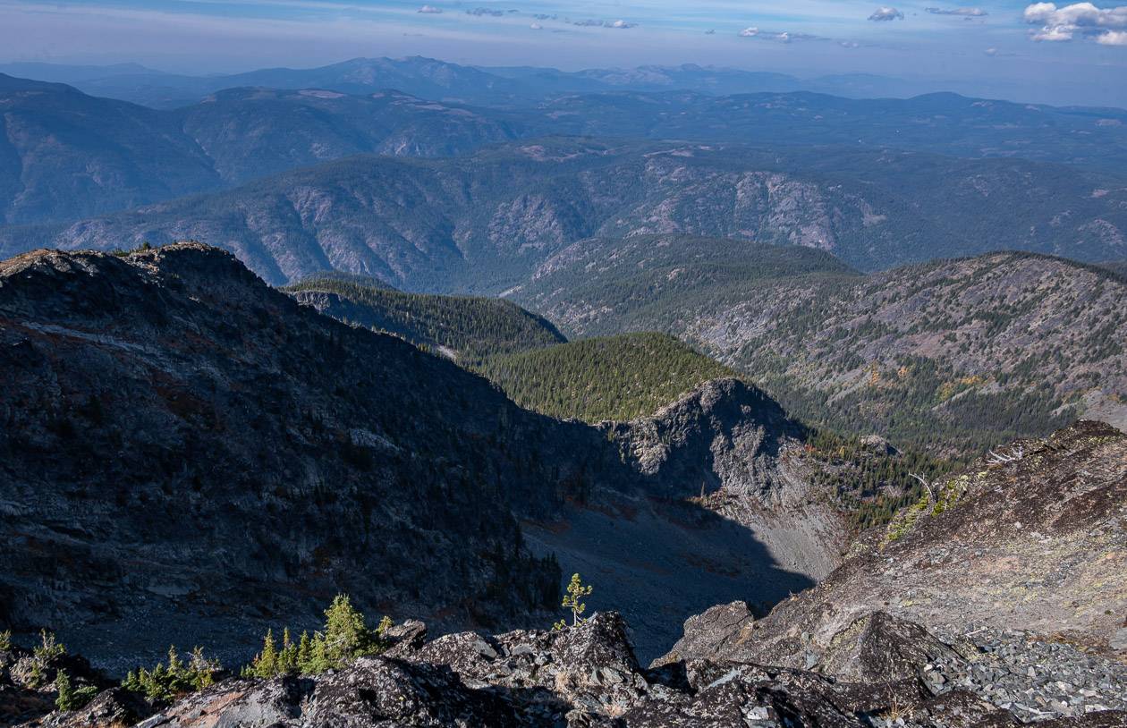
Climb through a forest that is particularly beautiful in fall with undergrowth decked out in fall colours. At around the 1 km mark, cross a bridge over Hanna Creek, and then another bridge shortly after.
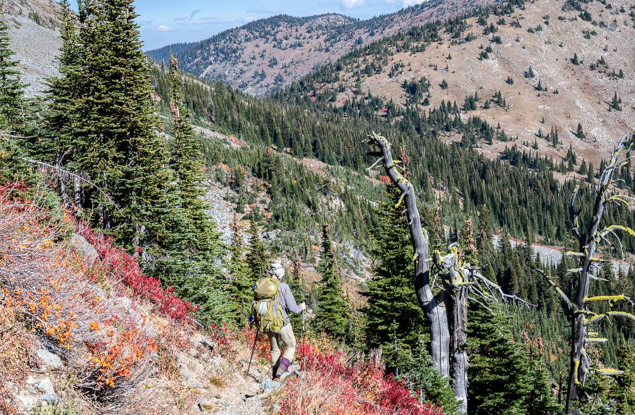
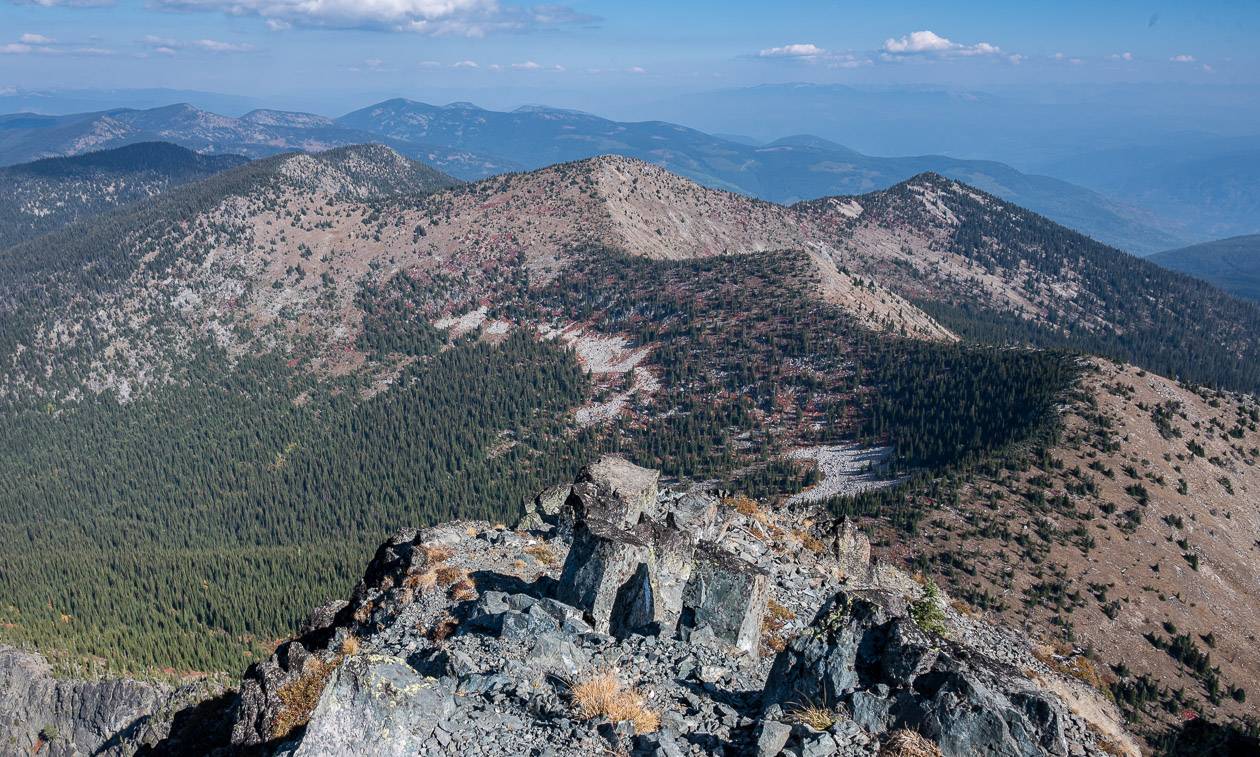
Start ascending the hill at a moderate grade. Reach Plewman Basin around the 3 km point. The forest starts to thin and in less than half a kilometre, there is a view of Mount Plewman, to the north on your right. After some switchbacking reach the intersection of the Plewman and Seven Summits Trail on top of Unnecessary Ridge. You’ll see signage here.
From the parking lot to Unnecessary Ridge, you’ve hiked 5 km and climbed 720 m. It took me about two hours to get to Unnecessary Ridge, where I enjoyed a break with a view.
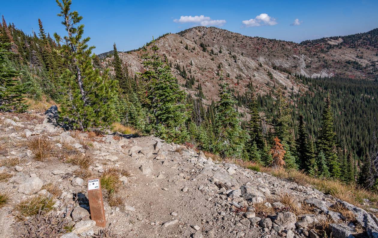
Turn left onto Unnecessary Ridge and follow it for 100 metres. Turn right again onto the trail that now takes you towards Old Glory Mountain. This is the intersection you’ll return to on the descent.
You will have a choice of retracing your route on the Plewman Trail or returning on the gentler but longer Old Glory Trail.
From the sign below, follow the trail towards Old Glory Mountain across a dry, rocky slope, dropping 50 m to reach Esling Creek Basin. The trail will reveal itself in the trees. It first curves southwest across a boulder field that is part of the mountains east slope. Then the trail climbs at a moderate rate and starts to curve north around the south shoulder of Old Glory Mountain.
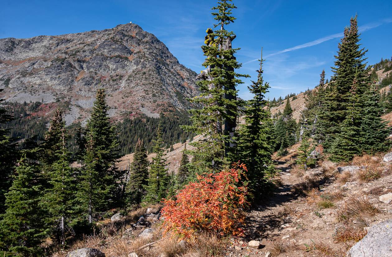
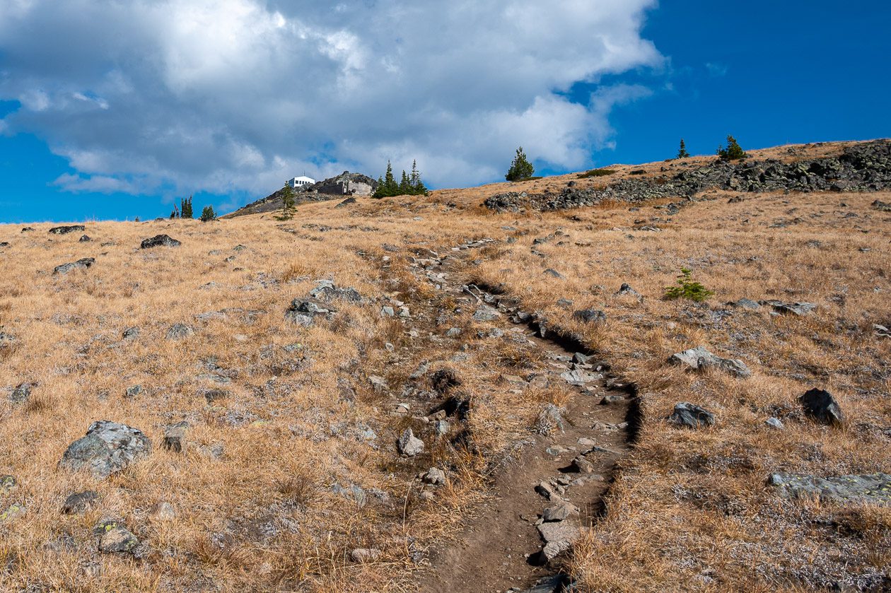
Reach the summit of Old Glory Mountain after 2.5 km of hiking from Unnecessary Ridge. You will have climbed an additional 345 m from the intersection. I had the summit to myself – and thoroughly enjoyed the solitude and the views.
I wouldn’t recommend using your cell phone near the summit – as there’s a good chance you’ll be charged for roaming in the US – as the US – Canada border isn’t very far off.
The descent from Old Glory Mountain
I simply retraced my steps all the way back to the parking lot. I didn’t find the Plewman Trail to be a difficult descent in the least.
Your other option at the intersection with the Seven Summits Trail is to go right on the Seven Summits Trail and eventually pick up Old Glory Trail. Enjoy a ridge-top walk for 1.6 km and then start descending in a southeasterly direction to reach a junction in a saddle. Take a left to get on the Old Glory Trail, an old road, that will take you down to within 100 metres of the parking lot. If you stayed on the Seven Summits Trail you’d reach Mount Grey. Keep an eye out for mountain bikers when you’re on the Seven Summits Trail.
Final thoughts
I think the Old Glory Mountain hike is a standout for the views – but in fall the colours add a whole other dimension especially when you happen on patches of bright red foliage. Go prepared with extra clothing and the hiking essentials – and enjoy.
Where to stay in Rossland, BC
The Josie Hotel at Red Mountain Resort is a fantastic place to stay. Many rooms have views out to the ski hills – which in summer are covered in wildflowers. This is the best out of town option, yet it’s still only a 5 – 10-minute drive away from Rossland.
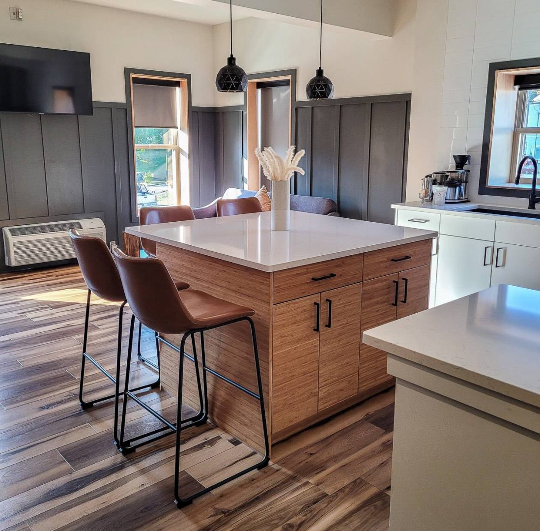
In Rossland I highly recommend The Flying Steamshovel Inn. The rooms are freshly renovated, with a bright clean aesthetic. I adored my room – which came with a kitchen, eating area and sitting room.
Further reading on things to do in the Kootenays
- 3 Nakusp Area Hot Springs That are Worth a Visit
- Valhalla Provincial Park for One of the Best Hikes in BC
- The Hermit Trail Hike in Glacier National Park BC
- 5 of the Best Things to do Near Nelson, BC
- The Stunning Hike to the Kokanee Glacier Cabin