Update: the below resource guide was written to complement a webinar, “Improving Infrastructure for Fish + People”, which featured panelists from federal agencies administering funds; a recording of that webinar is available here.
Written by Braeden Van Deynze, UW Postdoctoral Research Associate; Ailene Ettinger, Quantitative Ecologist at TNC in Washington; and Tiffany Choe, Public Funding Strategy Manager at TNC in Washington.
Migratory fish in Washington, most notably populations of Chinook, sockeye, and coho salmon, face numerous barriers to their migrations. Many of these barriers result from the design of transportation infrastructure, including aging culverts at stream-road crossings and toxic chemicals that reach rivers and streams from stormwater runoff.
With the passage of the 2021 Bipartisan Infrastructure Law, federal agencies are set to invest billions in America’s infrastructure, presenting unique opportunities for our communities to modernize roads in ways that support transportation goals while also protecting salmon and their ecosystems. Community-identified projects are more likely to be successfully funded and successful in meeting their objectives, when informed by the best-available scientific evidence.
To celebrate World Fish Migration Day 2022 and in advance of these upcoming funding opportunities, we have prepared some resources to help applicants better identify both grant programs and science resources to support strong proposals. On this page, we suggest how recently developed scientific resources can be matched to specific scoring criteria funding agencies use when selecting projects. This resource guide is a starting point—it is not all-encompassing, and additional funding programs and resources may be made available in subsequent posts.
Old culverts can be removed and replaced with a bridge to benefit fish habitat and manage peak flows. Photo by Zoe van Duivenbode / The Nature Conservancy.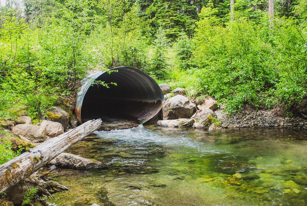
Two Federal Funding Programs: FEMA’s BRIC & NOAA CBR
FEMA’s Building Resilient Infrastructure and Communities (BRIC) and NOAA’s Community-based Restoration Program (CBR) are two grant programs set to receive over $1 billion in funding from the Bipartisan Infrastructure Law. These programs are opportunities for practitioners to partner with local communities to receive large investments of federal dollars to support people and nature. Both programs can support fish-friendly infrastructure projects. A couple examples of what fish-friendly infrastructure projects could look like would be restoration of failing culverts blocking upstream spawning habitat and green stormwater infrastructure like toxin-filtering bioswales.
FEMA Building Resilient Infrastructure and Communities
This grant program provides funds for hazard mitigation planning and the implementation of mitigation projects prior to a disaster. BRIC seeks to fund mitigation projects, which incorporate nature based solutions. Eligible fish-focused projects include both culvert restoration and green stormwater infrastructure, such as pervious pavers, bioretention cells, and bioswales.
To be the most competitive for funding, applicants must identify a natural hazard for which there is a formal hazard declaration, meet and demonstrate a stringent cost-benefit analysis ratio, prove how the project will mitigate that hazard and protect human lives with additional points towards projects that demonstrate nature-based solutions, leverage partnerships and communities and anticipate climate change. Scoring criteria are broken down into two categories: qualitative and technical. Successfully funded projects score well on both.
NOAA Community-Based Restoration Program
This program provides funding and technical assistance for restoration projects that ensure fish have access to high-quality habitat. The goal of these projects is to recover and sustain fisheries—particularly those managed as endangered or threatened under the Endangered Species Act (ESA). Fish-focused projects include hydrologic reconnection of wetlands, culvert removals and upgrades, and habitat restoration. Feasibility, design, and implementation projects are all eligible.
To be the most competitive for funding, applicants must identify a target fish species and then demonstrate how degradation in fish habitat and intended restoration action is both in alignment with ESA Recovery Plans and local planning (watershed plans, or other fishery-related strategic planning, conservation, or management documents) with additional points for projects which leverage partnerships and communities and focuses on larger scale restoration efforts.
Salmon swimming in a stream. Photo: public domain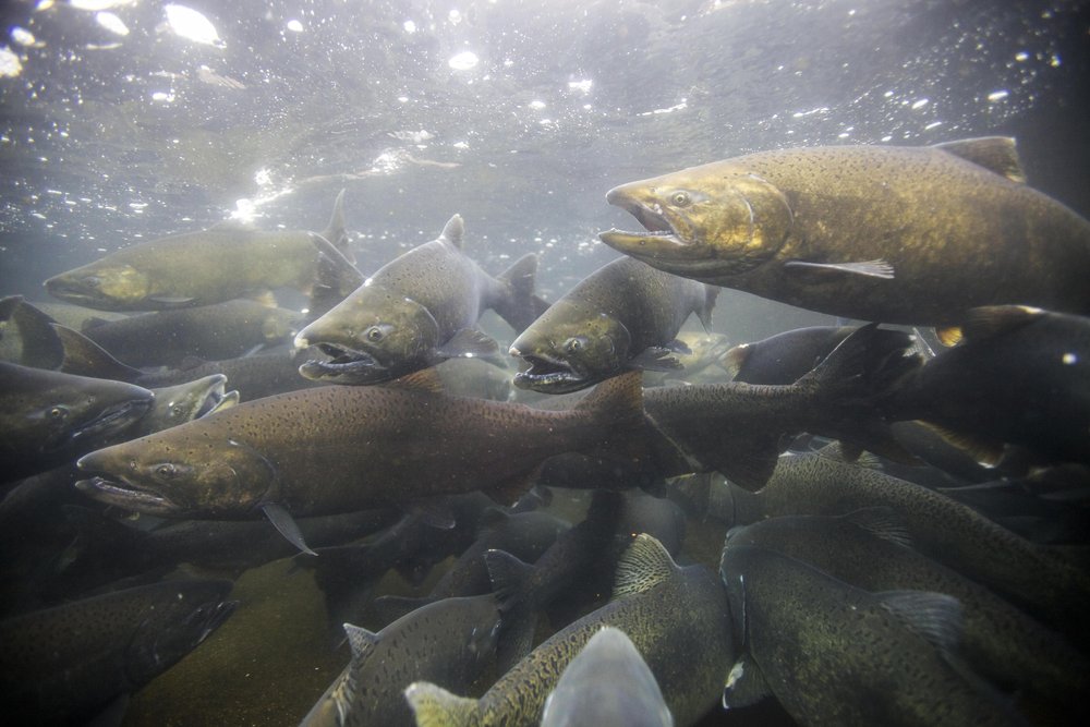
Scientific Resources to Support Fish-Friendly Infrastructure
Identifying the funding opportunity for fish-friendly projects is the first step. In order to be competitive for funding, projects must meet a set of program-specific criteria. The criteria for both NOAA CBR and FEMA’s BRIC require quantitative and technical background grounded in science.
While each program has a detailed list of scoring criteria, we identified key themes with recent scientific advances by TNC researchers and partners: climate change, water quality and community health and wellbeing. Each of the resource summaries below identifies the specific criteria each program uses that fall within these themes, followed by brief highlights of scientific resources that can be used to support strong scores for each category.
Climate Change
With the effects of climate change increasingly apparent, funding agencies recognize the importance of building infrastructure resilient to future conditions. Applicants can strengthen their proposals by demonstrating that their designs consider the best-available projections of how streams will evolve in the future.
Relevant Proposal Criteria
-
FEMA BRIC: Climate Resilience, Future Conditions (Qualitative Criteria)
-
NOAA CBR: Sustainability, Resilience, Future conditions (Scoring Criteria)
Suggested Science Resources
-
The Western Olympic Peninsula Fish Barrier Decision Support Tool, a product of the Coast Salmon Partnership, includes maps of predicted 2080 mean stream temperatures and seasonal flows for watersheds across the Washington Coast. Look for the Steam Temperature 2080 and USFS Climate Change VIC Model 2080 in the “Layers” panel on to the right of the map. These data can be used to characterize future habitat conditions at a project site.
-
The Climate Robust Culvert Design project, led by the University of Washington Climate Impacts Group and the Washington State Department of Fish and Wildlife, uses the latest climate projections to simulate future stream conditions and their effects on culvert passability across Washington state. These tools can be used to predict whether a culvert is likely to fail in the future as streamflows become more variable, or to justify a larger or smaller design robust to future climate conditions. Check out their latest report for details on how to access these tools.
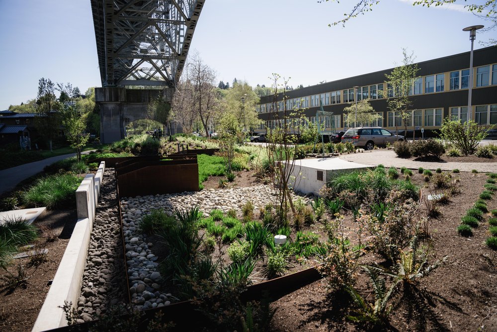
The Aurora Bridge Bioswale project was designed to clean up toxic stormwater coming off this Seattle bridge. Runoff passes through a series of natural filters to raingardens below. Photo by Courtney Baxter / TNC
Water Quality
Removing physical barriers for fish passage is a key component for successful restoration of many migrating fish populations, but it is often not enough. Water quality is critical as well, especially in urban areas and other locations that tend to have water with high levels of chemicals that can be toxic to fish. Green stormwater infrastructure projects enhance salmon habitat and ecosystem function while simultaneously providing benefits to humans including flood control.
Relevant Proposal Criteria
-
FEMA BRIC: Risk Reduction and Resilience (Qualitative Criteria); Infrastructure, Mitigating Risk to Lifelines (Technical Criteria)
-
NOAA CBR: Technical and scientific merit: barriers to fish survivability, Project feasibility and methodology to lead to success (monitoring)
Suggested Science Resources
-
The Stormwater Heatmap was designed to help communities take targeted, high-impact action to mitigate stormwater pollution. The Stormwater Heatmap metrics can be used to help prioritize “green” and “gray” infrastructure investments in pollution hotspot locations across the Puget Sound Region.
-
The open-access “Roads to ruin” paper and StoryMap by Feist and colleagues highlight hot spots of coho salmon pre-spawn mortality, or urban die-off, associated with urbanization and polluted stormwater.
-
This freely accessible paper by Ettinger and colleagues details one way to prioritize particular locations for restoration, demonstrating that identifying the organism(s) you aim to benefit (e.g., coho versus Chinook salmon) is a critical step, as locations differ depending on the focal species. This open-access paper by Levin and colleagues shows how the scale of restoration required to have an impact also differs depending on the focal species.
-
For more detail on the chemicals linked to coho salmon die-off, see this paper by Tian and colleagues on the ubiquitous tire rubber-derived chemical that took a team of researchers decades to identify, and this paper by Peter and colleagues characterizing the chemical profile associated with other measured declines in biological health of urban watersheds.
Community Health and Wellbeing
New and emerging science can be leveraged to help communities work together in centering community health and equity while addressing urgent needs of migratory fish.
Relevant Proposal Criteria
-
FEMA BRIC: Risk Reduction, Population impacted, outreach (Qualitative Criteria); Increased Cost Share, Economic Disadvantaged Rural Communities (Technical Criteria)
-
NOAA CBR: Outreach and education, stakeholder engagement and support, technical expertise of those applying and managing the award
Suggested Science Resources
-
For projects focused on flood risk and vulnerability, this freely available “Fine-scale assessment of inland flood vulnerability” paper and associated maps and data provide estimates of flood risk and vulnerability across Washington state at household to neighborhood scale. There are stark racial inequities in inland flood risk and vulnerability; for example, Latinx residents comprise 8% of the state’s population, but 16% of residents in flood zones, and communities with more Latinx, Black, & Indigenous households are more vulnerable.
-
The Environmental Health Disparities Map is an interactive, free, online tool that ranks the cumulative risk from environmental factors that influence health outcomes in neighborhoods across Washington state. It includes customizable map views to identify “where living and economic conditions combine with pollution to contribute to inequitable health outcomes and unequal access to healthy communities.”