If you’re in the vicinity of Campbell River, I think it’s well worth the 2.5 – 3.5 hours to do the return hike on the Ripple Rock trail. Wander through a scenic, lush forest filled with ferns, salal, and mossy logs, past some monster big Douglas-fir trees to a viewpoint over the roiling, rough waters of Seymour Narrows. This is the 1958 site of one of the largest non-nuclear explosions in the world. (More information below.)
Plan to spend some time at the Ripple Rock trail viewpoint as it’s a lot of fun to watch the boats and ships go through the turbulent waters. I’ve gone through in a boat on the Campbell River wildlife tour – and it was an unforgettable experience. Looking up close at the whirlpools is a wee bit terrifying!
This post includes some affiliate links. If you make a qualifying purchase through one of these links, I will receive a small percentage of the sale at no extra cost to you. Thank you very much for your support.
Ripple Rock trail hike summary
Distance: 8.0 km return.
Level of difficulty: Easy and family friendly with kids 6+.
Elevation gain: 95 m or 312 feet
Time needed: 2.5 – 3.5 hours of hiking time. Plan to take a picnic lunch, then sit back and watch the boats go through Seymour Narrows.
When to visit: Year-round but avoid the trail on stormy or very windy days.
What to take: Wear good footwear with a tread as it can be muddy.
Know before you go: Visit Destination BC’s Know Before You Go page. With conditions changing rapidly, it also pays to check out Drive BC, BC Wildfire Service, and Emergency Info BC. It would be a good idea to download and allow notifications from Alertable, an app which delivers geographically relevant updates.
Dogs allowed: Yes, on a leash.
Wildlife: This is black bear country so always carry easy to access bear spray. I’d suggest keeping it in abear spray holsterso you don’t set it off accidentally.
Plants to look for: Sitka valerian, wingstem monkeyflower, white fawn lily, chocolate lily, pink fawn lily, giant horsetail, spring orange-peel fungus, Siberian miner’s lettuce, maidenhair spleenwort.
Watch for: Do a tick check post hike in the spring.
Don’t forget: Pack the 10 hiking essentials – even for this short hike.
Please: Practice the seven Leave No Trace principles. We all want to visit a clean Ripple Rock trail, free of garbage.
Ripple Rock trailhead location
The Ripple Rock trail is easy to find. Simply drive north out of Campbell River on Highway 19. From the river crossing in town, it’s about 17 km. The trail is well-signed on the highway. A toilet is the only facility you’ll find in the medium-sized parking lot..
Ripple Rock trail location map
Ripple Rock trail description
The easy to follow out and back trail begins at the northeast corner of the parking lot. Start off by descending on a powerline access road, losing about 80 m of elevation. Cross Menzies Creek on the bridge pictured below. At the end of the bridge is an impossible-to-miss old-growth Douglas fir tree. It’s a beauty and will fill you with awe.
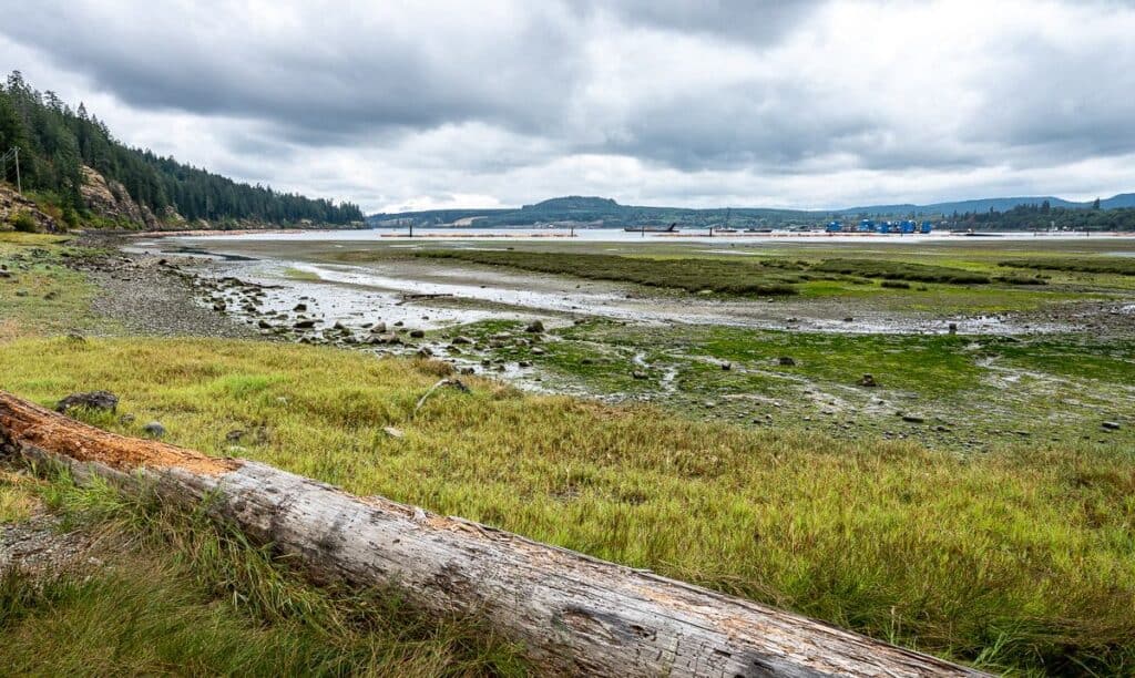
After you’ve hiked for 1.2 km on the Ripple Rock trail, you’ll reach a wet, shallow access point to Menzies Bay. Look out over the water at all the tugboats and log booms.
The trail gets rougher as it moves up into thick trees. There are a good set of stairs that have made the hiking easier. Continue through the mossy forest along a sword fern-edged trail to reach another open bluff at 2.6 km. There is a picnic table here too, but the better view is from the rocks.
Reach the shore of Nymphe Cove at 3.6 km, situated between Stephenson Point and Wilfred Point. If it’s a hot day, take off your shoes and wander the small shoreline – though it’s not a good place for a swim.
From here the real climbing on the Ripple Rock trail begins. Over the next 0.5 km gain 95 m. You’ll climb a steep wooden staircase pictured below. From there, follow the trail across outcrops of rock, underneath powerlines (not the prettiest) to a terrific viewpoint high up on the cliff.
From here if you time it right you can watch everything from small motorboats to cruise ships navigate the waters of Seymour Narrows. It’s a site to see how quickly they move through the area.
When you’ve had your fill, retrace your steps to the parking lot.
Ripple Rock Trail photos
The world’s largest non-nuclear explosion
Seymour Narrows was home to one of the most notorious marine hazards until 1958 – Ripple Rock. It consisted of two rock pinnacles that lay 1.8 metres and 2.7 metres below the surface at low tide. These two pinnacles caused a restriction in the flow of water through the narrows and with resultant water speeds in the order of 15 – 20 knots. They also caused massive whirlpools to form.
Ripple Rock was responsible for damage to dozens of ships and claimed at least 114 lives.
It took some ingenuity to get rid of Ripple Rock. A tunnel under the seabed into both rock pinnacles was started in 1956 and completed 27 months later. Over one kilometre of fuse was laid – and 1,250,000 kg of explosives were placed in the pinnacles.
On April 5, 1958, the blast was triggered. It created the largest non-nuclear explosion in history. Reportedly the explosion broke 370,000 tons of rock AND moved 220,000 tons of water but No tidal wave was formed.
The clearance over the rock pinnacles at low tide is now 13 m and 14m – but as you can see below there are still currents and whirlpools to deal with. Have a look at this Facebook video of Ripple Rock to see just how fast a boat moves through the area when going with the tide and current. It’s a mesmerizing sight.
Where to stay in the Campbell River area
If you stay atPainter’s Lodgeyou’ll feel a tad removed from Campbell River – in a good way. It’s on the water so salmon fishing and nature tours leave right from its docks. Across on Quadra Island there is a sister property that’s a bit more rustic –April Point Resort & Spa. I liked the feel of this place and the gorgeous views.
Oyster Bay Resort-13 km from Campbell River, is rated as fabulous. Rooms come with a full kitchenette.
TheCoast Discovery Inn-rated as good, overlooks the Strait of Georgia and features an onsite restaurant.
Yellow Door Suite– rated exceptional, features a guest house with an outdoor dining area. The guest house comes with a bedroom, living room and an equipped kitchen.
Further reading on Vancouver Island hikes
San Josef Bay Hike & Camp, Cape Scott Park
Nootka Trail Hike: A Complete Guide & Trip Report
Hiking in Victoria BC – A Couple of the Must Do Trails
A Four Day Hiking Trip on the Juan de Fuca Trail
A Hike on the Coast Trail in East Sooke Park, BC
Click on the photo to bookmark to your Pinterest boards.