The Columbia and Western rail trail spans an impressive 162 kilometres between Midway and Castlegar in southern British Columbia, following the path of the abandoned Canadian Pacific Boundary Subdivision line. This blog showcases the 50 km section of the Columbia and Western Rail trail you can access just off the Paulson Summit on Highway 3 through to Castlegar.
I did the bike ride solo – but I did get a Columbia Western Railgrade shuttle with Kootenay Gateway, leaving my car at the end of the bike ride. All I had to do was bike back to Castlegar, and avoid logging trucks on the first 25 km or so of the bike ride – but more on that later.
The Columbia and Western rail trail owes its existence to the discovery of gold and copper near Rossland in 1890. The initial plan was to run the railway from Trail to Penticton, though in the end, Midway was the last stop, and it wasn’t completed until 1900. The railway was in use for 50 years. You will see some relics along the trail and lots of interesting interpretive signage.
This post includes some affiliate links. If you make a qualifying purchase through one of these links, I will receive a small percentage of the sale at no extra cost to you. Thank you very much for your support.
Location map of the Columbia and Western rail trail
**Click on the three dots near the top right hand corner to email a copy of the map.**
Biking sections on the Columbia and Western Rail Trail
There are three main sections to the 162-kilometre long Columbia and Western Trail. The distances below are approximate.
Midway to Grand Forks – 50 km
Grand Forks to Christina Lake – 25 km
Christina Lake to the town of Castlegar – 87 km
In Midway, you can connect to the Kettle Valley Rail Trail – which is your ticket to exploring part of the Okanagan region through to Hope.
In total, you can bike 493 km between Castlegar and Hope on a combination of the Columbia and Western and Kettle Valley rail trails – on what is part of the 28,000-km-long Trans-Canada Trail. You’ll encounter remote sections on both rail trails, but if you’re an adventurous, self-supported bikepacker, you can string the two together. You’ll need about 10 days to bike the two rail trails together.
Highlights of the Columbia and Western rail trail to Castlegar
Farron Summit: The high point on the full Columbia and Western rail trail is the Farron Summit at 1,200 m. Look for interpretive panels, a nice shelter with picnic tables and an outhouse.
Tunnels: There are four tunnels on this section of the Columbia and Western rail trail – three that you’re through in short order and the 960-m-long inky-black Bulldog Tunnel which in theory is meant to be shared with logging trucks. It’s best walked as the ground is sandy, uneven and wet in places.
Arrow Lake views: Enjoy almost 20 kilometres of on and off lake views starting from the viewpoint a few km north of Coykendahl most of the way through to the parking lot at 8.8 km.
Trestle bridges: There are several trestle bridges on the route to Castlegar you’ll cross as you bike parallel to Lower Arrow Lake.
Who uses the Columbia and Western rail trail
Keep an eye out for people hiking or on horseback as the Columbia and Western rail trail is multi-use.
There are some sections too (like the stretch from Castlegar to the Bulldog Tunnel) where ATV’s are allowed. Fortunately, the two guys I saw were out of earshot in short order and I didn’t have to deal with any more dust.
Getting to the trailhead
Castlegar trailhead
Look for lots of free parking at the Castlegar C&W trailhead at the end of Arrow Lakes Drive just past the Lafarge Plant.
Many people will simply do an out and back bike ride from here – perhaps going as far as the Bulldog Tunnel and returning.
Trailhead off the Paulson Bypass
The other option is to do a car shuttle or hire a shuttle company like Kootenay Gateway to drive you and your bike to either the Christina Lake trailhead or the trailhead that is just a couple of kilometres north of the Paulson Summit via the Paulson Bypass trail.
To get there simply drive back to Castlegar, head south through town, and pick up Highway 3 just south of the Shell gas station. It’s about a 65-kilometre, 55-minute drive to get to a turnaround on the dirt road beside a sign showing a map of the Columbia and Western rail trail.
Columbia and Western rail trail summary
Distance from shuttle dropoff just below the Paulson Summit to Castlegar: Approximately 48.9 km. Add 8.5 km to cycle back to Bridge Street in Castlegar.
Level of difficulty: Easy biking except for the occasional rutted surface.
Elevation gain/loss according to Trailforks: +143 m/-797m
Time needed: 3 – 4 hours depending on fitness level and how many stops you make.
Grade of the Columbia and Western rail trail:
Paulson to Farron – 7.7 km at 1.7 % grade going up.
Farron to the Bulldog Tunnel – 12 km at 2% grade descending.
Bulldog Tunnel to Coykendahl – 7.2 km at 1.7% grade descending.
Coykendahl to Shields – 13 km at 2.2 % grade descending.
Shields to the parking lot (at 8.8 km) – 12.7 km – 1.3% descending.
Maps: I recommend Organic Maps for hiking and biking maps as they work offline.
Pit toilets: Farron summit and the parking lot at km 8.8 in Castlegar.
Biking conditions: Surprisingly variable. It’s a mixture of gravel and packed dirt. Sometimes the gravel is quite thick. On my bike ride there were many kilometres or rail trail with two sets of deep treads, so you had to keep weaving back and forth looking for smoother conditions.
If it rains, be prepared for a lot of mud. If it hasn’t rained in a while it will be particularly dusty – especially when the logging trucks pass. Considertaking a buffyou can pull up over your nose when you see a truck heading your way.
Logging truck warning
You might be surprised at how hard it is to hear logging trucks when you’re biking because of all the noise your bike makes on gravel. On several occasions they were very close by when I noticed them. Pull way over and cover your head to minimize the dust left in their wake.
The Bulldog Tunnel sees a lot of logging trucks going in both directions – at least on a Monday to Friday basis. I’m not sure if they are a problem on the weekend, The logging trucks are SUPPOSED TO STOP when they see a biker/hiker…in the tunnel. Then you walk your bike past them while they are stopped.
My experience was this. I entered the Bulldog Tunnel on foot with my headlamp on – pushing my bike with one hand and trying to see a little further with my phone in the other hand. Both light sources were almost useless by the time I was in about 20 m. I wasn’t feeling at all good about what would happen if I met a logging truck, so I turned around and walked back out. I checked out the trail you can see in the second photo below to see if there was a way over the top. There was nothing I could find.
Then I waited for a logging truck to come through and waved the driver to stop. He told me there was no one behind him and wouldn’t be for some time. I asked him to radio ahead and warn any incoming trucks that I was walking through the tunnel. He offered to stop any trucks on his way out and told me to take my time. I ran close to a kilometre with my bike. I was taking no chances.
You share about 25 km of the Columbia and Western rail trail with logging trucks (as the logging company looks after road/trail upkeep) but you must be able to pull off the road VERY quick
Best time to bike the Columbia and Western rail trail
Spring through fall is the best time to bike the Columbia and Western rail trail. Expect mud in spring, heat in summer, and dustier conditions and colourful foliage in fall.
Before you go check out Alertable – especially in summer when fire danger might be high.
According to one report I read, you can expect a lot of quads and ATV’s on weekends.
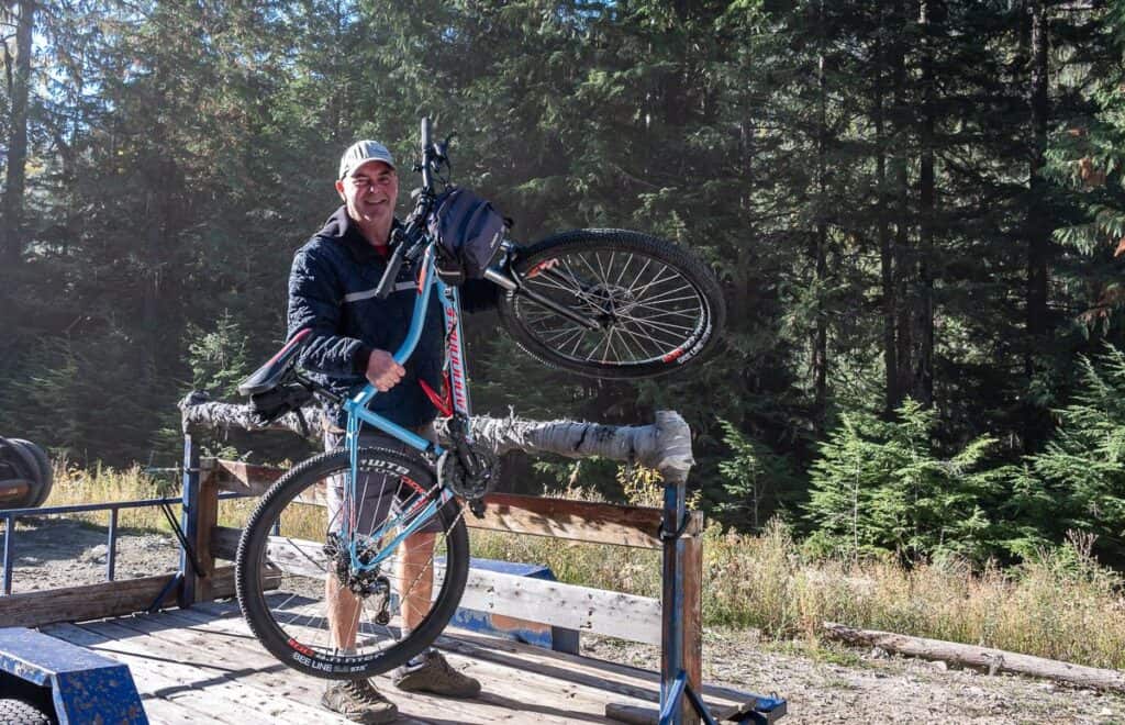
My Columbia and Western Rail Trail biking experience
I started out at about 10 AM on a beautiful fall day. I never did see another cyclist until I was within 5 km of the Catslegar trailhead.
Biking on the Columbia and Western rail trail is easy as most of the trail is a little wider than a logging truck. I found that there was lots of room to weave back and forth when the trail got rough.
Look for signage every kilometre. I took a wrong turn shortly after the Farron Summit at a Y intersection – going left and down a lot – which didn’t feel right because the grade is never more than a few percent up or down. After backtracking, it was straightforward.
I found the scenery got more interesting once I reached the Farron Summit with mountain views appearing well before the Bulldog Tunnel. The biking too got much easier as it was all downhill to Castlegar from here on a 1.2 – 2.2% rail grade trail.
Interpretive panels were at most shelters and periodically along the rail trail when something historically significant had taken place nearby.
Where I lost the logging trucks
After the Bulldog Tunnel, there are still a couple of kilometres where you share the trail with logging trucks. Once you pass the live logging area where trees are being cut down and the trucks are being loaded with logs, you can relax. This is the turn around point for the trucks.
It was blissfully quiet on the rest of the Columbia and Western rail trail until I met the ATVers – but that noise interruption was short-lived.
Scenic viewpoints, trestles and short tunnels
There’s a scenic viewpoint of the mountains and Arrow Lake just as you start to head southeast along the rail trail. The views continue on and off for the rest of the bike ride to Castlegar.
I loved this section of the trail as there were several short tunnels and trestles to keep it interesting. While there were a few short sections of trail with dropoffs – they were fenced off and easy to avoid.
Over the length of the trail there were numerous picnic shelters or benches where you could enjoy a picnic. It was always a good place to check my location on the map, sit and just take in the beauty of where I was.
You’ll probably start running into hikers and bikers on the last 5 km of the rail trail. Keep an eye out for them as you can fly down on this part of the trail because it’s in great shape.
What to bring
Bikes: I took my mountain bike, and it worked splendidly. A gravel or fat bike would also be a good choice, but a road bike would not. Don’t forget yourbike helmetandbike gloves.
Headlamp: I highly recommend a very good headlamp likethis one made by Fenixfor the Bulldog Tunnel. Your cellphone and even a regular headlamp don’t even begin to cut through the inky blackness, especially if you are biking up from Castlegar. There’s a significant curve in the tunnel which allows you to see a pinpoint of light after about 100 m GOING towards Castlegar. But heading the other way, it’s going to be blacker than black for 750 – 800 m.
Clothing: Pack a raincoat and extra wicking layers if the weather takes a turn for the worse.
Photos of the Columbia and Western rail trail to Castlegar
The following photos should give you a good idea of what to expect while biking the Columbia and Western trail towards Castlegar from the Paulson Summit.
Safety Tips
Use common sense when biking the Columbia and Western Rail trail. Ideally cycle with someone – because it’s more fun but also safer of you have an emergency on the trail. If you’re biking solo like I was, don’t take chances. Instagram glory on rocky promontories or bridges isn’t worth it. I also carried bear spray though I didn’t see any bear scat.
Water: Take lots of water and perhaps some water purification tablets should you drink what you brought. There are a few small streams where you can fill up.
Food: You’ll burn a lot of calories so pack some energy rich power bars and a full lunch. There are lots of places with picnic tables to stop at.
Repairs: Carry a first-aid kit to repair your body and bike repair tools – especially for flats on the gravel. Don’t forget a bike pump.
Cell service: This is a remote trail. Be sure to let someone know where you’re going and when you’re due back. For most of the bike ride, I didn’t have cell service.
Bike shops in the Castlegar – Rossland area
There are several bike shops in Castlegar.
Cycology Bikes services bikes but doesn’t rent them.
Kootenay Valley Cycle sells bikes and parts but doesn’t rent them.
Valhalla Bicycle is a mobile bicycle repair service in the West Kootenays. Call 778-960-1115.
If you need a bike rental head to nearby Rossland and visit Revolution Cycles. They are closed Sundays and holidays.
Where to stay and eat in Castlegar
Windborne Bed and Breakfast
I had the pleasure of a two night stay atWindborne Bed & Breakfastabout a 10-minute drive from downtown Castlegar. My room was big and comfortable with a deck overlooking their extensive garden. Breakfast was whatever I wanted it to be – and plenty of suggestions were provided on where to eat in Castlegar.
Where to eat in Castlegar
For coffee check out Common Ground Coffee or Crumbs Bakery Cafe.
For a meal with a view, head to The Nineteenth – at the golf course overlooking Castlegar.
The Grateful Table is another top choice for dinner.
Final thoughts
I hope you love your biking experience on the Columbia and Western rail trail – even with the logging trucks and ATV’s. Please feel free to reach out to me if you have any questions. It’s always fun to hear from my readers.
My question to you is – have you ever biked a rail trail in British Columbia or elsewhere in Canada or the United States? Let me know in the comments – where you biked and what the experience was like.
More reading on things to do in the Kootenay Rockies
Visit the BC’s Kootenay Rockies website for more information on the region.
The Old Glory Mountain Hike Near Rossland (You can see the mountain on the shuttle to the trailhead.)
Things to Do in Rossland, BC If You Have 3 Days
Bike Myra Canyon on the Amazing Kettle Valley Railway
5 of the Best Things to Do Near Nelson, BC
Gwillim Lakes Hike in Valhalla Provincial Park
Click on the photo to bookmark to your Pinterest boards.